Cold clouds will usually have a combination of ice crystals and super-cooled water, the first step in the process of creating precipitation in cold clouds.

Why cold clouds are the main source of summer rains

Even in the heat of summer the unique processes of cold clouds are important

If you missed my last article, we looked at how precipitation forms in warm clouds, after all it is the middle of summer. With the warm summer temperatures one might assume that most of our precipitation would come from warm clouds at this time of year, but in reality, most of our summertime precipitation comes

Forecast: Nice mid-summer weather on tap

Issued July 22, 2019: Covering the period from July 24 to July 31

While the weather models may not be bang on with their forecasts, they have been doing a pretty darned good job with the big-weather picture. We saw this once again during the last forecast period which saw plenty of active weather during the first half followed by dry, sunny, warm weather in the second half.


Warm air has the capacity to hold much more water than cold air. The question is, by how much?

Measuring atmospheric moisture not easy

Relative humidity has to be one of the most misunderstood terms in weatherspeak

If you have been reading my articles over the years you know I have a few weather pet peeves. This article’s pet peeve is probably on the top of my list as I hear it discussed again and again, and people just don’t seem to properly understand this topic. So, even though I seem to

Blocking patterns and summer heat waves

Blocking patterns and summer heat waves

Consistently warm weather may follow if this blocking pattern breaks down next week

To begin our look at summer heat waves, with a hope of possibly breaking this cold weather pattern we seem to be stuck in, I thought we should begin by looking at blocking patterns. In early May I talked about upper-level lows, and these blocking patterns can often be associated with these upper lows. We


Forecast: Unsettled, unpredictable weather pattern

Issued June 17, 2019: Covering the period from June 19 to 26

Well, last week’s forecast turned out not too bad, considering this annoying weather pattern in which we seem to be stuck. The weather models seem to be having an OK time handling the large-scale features, but are struggling with the day-to-day details. This forecast period looks like it will be another tough one to figure

Forecast: Warmer, with a chance of showers

Issued June 3, 2019: Covering the period from June 5 to 12

Last week’s forecast played out fairly close to what the weather models were predicting with one major exception. The area of low pressure that tracked southeastward through our region last Friday didn’t bring much in the way of clouds or showers, but it did open the door for a very unseasonably cold air mass to


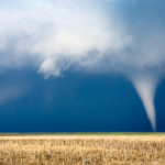
Tornado with dark storm clouds

Continuing with severe summer weather: Tornadoes

The peak tornado months within Canada’s tornado season are approaching

I know in the May 23 issue I said we would take a break from our annual look at severe weather and take a look back at the spring of 2019, then see what the latest long-range forecasts say. It appears I was a little ahead of myself as there are still five days left

Forecast: Seasonable with a chance of some rain

Issued May 20, 2019: Covering the period from May 22 to May 29

Surprisingly, last week’s forecast didn’t turn out too bad, considering all the differences between the weather models last weekend. Not sure what the better trade-off was: cool and dry, or cool and wet? From my observations, it seems like most of the planting has been done, and while there is OK soil moisture, things are


Forecast: Seasonable weather, but continued dry spell

Issued May 6, 2019: Covering the period from May 8 to May 15

It finally looks like we are almost done dealing with a large upper-level low that has been controlling our weather over the last couple of weeks. The main upper low did track across north-central Manitoba over the weekend as predicted, but instead of moving off into Quebec, it looks like it will meander over Hudson

Forecast: A slow warming trend ahead

Issued April 29, 2019: Covering the period from May 1 to May 8

Once again, last week’s forecast quickly fell apart as cool high pressure combined with a retrograding upper low over Northern Canada played havoc with the forecast. What looked to be a fairly wet period turned out to be dry, as the forecast areas of low pressure were pushed to our south with only far western