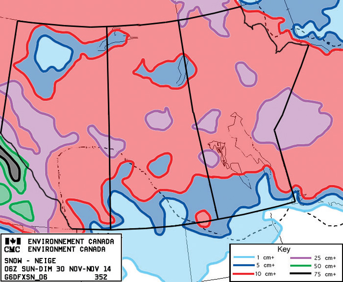
Our last forecast started off right on track, but a stronger-than-expected storm system brought widespread measurable snow to southern and central Manitoba last Friday and Saturday and altered the general flow enough to change the rest of the forecast.
Cold weather moved in behind this storm system, as high pressure dropped southeastward out of the western Arctic. This high will sit to our east during the first half of this forecast period and will actually slowly help our temperatures to warm up. As the high sits and spins it will slowly draw warm air northward along its western side. This means we should see daytime highs warm by a couple of degrees each day this week, making it to around -6 C by Friday. This large area of high pressure will also keep us in mainly clear skies with little chance of any snow.
Read Also
Forecasting spring 2026 weather on the Prairies
What weather can farmers expect across Manitoba, Alberta and Saskatchewan as they head into seeding? Plus: a lesson on what makes the seasons turn
Over the weekend a weak low may try to zip across from Alberta, but at most we’ll see some clouds and a few flurries from this system. A weak arctic high is then forecast to start sliding southeastward, but this high looks as if it will stay farther to the north, cutting across northern Manitoba. This should keep the coldest air well to our north, but we’ll see temperatures cool down a little bit to start next week.
Looking further ahead, the weather models show a strong storm system spinning up off the northern coast of B.C. These systems will often help to pull warm air up ahead of them, so I wouldn’t be surprised if we see mild weather move in late next week. We should also remain dry, at least until this large system finally moves ashore.
Usual temperature range for this period: Highs, -16 to 0 C; lows, -26 to -9 C.


