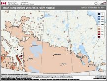
We’ve been in an interesting weather pattern over the last week or so, basically stuck between a large area of low pressure anchored over Hudson Bay and a ridge of high pressure to our west. This has placed us in a predominantly northerly flow, bringing well-below-average temperatures. The other interesting feature has been the occasional snows dropping down out of Hudson Bay. These systems, for the most part, have only brought a light dusting of snow, but to the lee of the still-open lakes, 10 to 20 cm of snow were reported.
Read Also

Thunderstorms and straight-line winds
Straight-line winds in thunderstorms can cause as much damage as a tornado and are next on our weather school list exploring how and why severe summer weather forms.
Over the next week or so the weather pattern does not look to change much. The good news is that this means the likelihood of seeing significant widespread snow is not that high. The bad news is that it looks as though temperatures will continue to be on the cold side.
Low pressure will continue to dominate over Hudson Bay, but it looks like it will slowly pull off to the east during this forecast period. Arctic high pressure will slide down across our region during the middle of the week, but the high does not look to be that strong. Nonetheless, we’ll continue to see cold weather under this high. By the weekend the high will strengthen as it moves to our southeast; this, combined with a deepening area of low pressure to the West Coast, should lead to slowly warming temperatures. Daytime highs by the weekend should be around -4 C with overnight lows around -10 C.
For next week, the weather models show a large storm system developing well to our south. We could see a few flurries on Monday as the low passes by, but the main impact will be slightly cooler temperatures. The models then show a low dropping down from the northwest around the middle of the week. This could bring the first widespread snow of the season, should it materialize.
Usual temperature range for this period: Highs, -11 to 2 C; lows, -20 to -6 C. Probability of precipitation falling as snow: 96 per cent.