Weather: Forecast models trending back to warm

Forecast covering the period from Sept. 22 to Sept. 29

It has been kind of interesting watching the weather models over the last couple of weeks. They keep trying to forecast cold air pushing south, but areas of low pressure seem to keep developing to our southwest and west. The counter-clockwise rotation around these lows stalls the southward progression of the cold air as warm

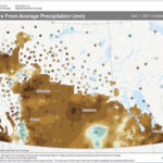
This map shows the amount of precipitation that has fallen this growing season (April 1 to Sept. 8) across the Prairies as a departure from average. A quick look at the map shows most areas were below average (browns), with only the areas near Regina, along the foothills southwest of Calgary and a small portion of the Peace River region receiving above-average amounts of precipitation.

Weather: Slowly cooling down

Forecast covering the period from Sept. 15 to Sept. 22

Well, what can I say? Thanks to an upper low that crossed the northern Prairies last week much slower than originally anticipated, the rest of the forecast kind of fell apart. That’s the tricky thing with forecasts: one change to a big system can have significant impacts further down the road. On a positive note,


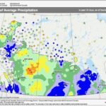
This issue’s map shows the amount of precipitation that fell during August (or more precisely, in the last 30 days ending Sept. 2), as a percentage of average. It was a wet month across a good portion of both Manitoba and Saskatchewan. Western Manitoba, northeastward into the northern Interlake and south-central Saskatchewan, were the wettest areas, with amounts more than doubling their long-term averages.

Weather: Plenty of chances for rain remain

FORECAST | Issued Sept. 3, 2021, covering the period from Sept. 8 to 15, 2021

Last week’s forecast played out fairly close to what the weather models predicted. We saw unsettled weather early in the period, with a return to sunshine over the long weekend. It did miss the odd shower over the weekend but was spot on with the temperatures. The weather models then called for an area of low pressure to move in

Weather: Nice long weekend expected

Forecast covering the period from September 1 to 8

We saw the expected unsettled weather from our previous forecast, and in fact, the two areas of low pressure ended up being much stronger and slower moving than the models predicted, resulting in a longer period of cooler temperatures. Cooler summer temperatures usually mean daytime clouds — something most regions dealt with during a good part of last week.


Weather: A cooler end to the month

Forecast covering the period from August 25 to September 1

As I work on creating this forecast, for the first time in several months, a large area of low pressure is poised to move through southern and central Manitoba, bringing with it the first widespread rains in a long time. The big question is whether this is a switch in the hot, dry pattern we have been in,

Weather: Warm then cool trend seems established

Forecast covering the period from August 18 to August 25

Interestingly, the last week’s forecast called for cool and unsettled weather from August 10 to 13, due to a couple of weak areas of low pressure. Those lows formed as forecasted, but the first low turned into a large upper low that then captured the second low. The long and short of it is that we got


Weather: An unsettled start with chances for improvement

Forecast covering the period from August 11 to August 18

It is not that surprising with weak storm systems moving through, plenty of ridging and not a lot of moisture that the weather models are struggling a little bit with the timing and placement of systems, but the overall pattern is being forecasted quite well. Since the systems are weak, we tend not to notice

Weather: No real break from the heat in sight

Forecast covering the period from August 4 to August 11

Well, if anything, the weather pattern is consistent. My forecast last week didn’t do a bad job, but when you have such a consistent pattern, all you really have to do is say, “today is going to be the same as yesterday.” The last forecast called for a couple of chances for showers, and those


Weather: General pattern remains the same

Forecast covering the period from July 28 to August 4

Wind speed and direction are two of the toughest things to forecast. Normally, being off on these weather features does not have a large impact on the overall forecast, but when we are dealing with smoke, it certainly can. Now I am not saying the wind forecast was off in the last issue, but that

Weather: Stuck in a hot, dry pattern

Forecast covering the period from July 21 to 28

If this is not a persistent pattern, I do not know what is. Let’s see, the week starts off nice, with temperatures in the low to mid-20s along with the odd widely scattered shower or thunderstorm. Then by mid- to late week, the temperatures jump back up into the low to possibly mid-30s, with those