Pattern trying to transition to winter

Issued: Monday, Nov. 3, 2014 – Covering: Nov. 5 – Nov. 12, 2014

Last week’s Arctic high built in as expected, but brought slightly cooler temperatures than expected, with overnight lows dropping into the minus teens late last week. The strong area of low pressure also developed to our west as predicted, but fortunately for us, it took a more northerly route and brought nice mild weather to

Mild October weather to continue

Issued: Monday, Oct. 20, 2014 – Covering: Oct. 22 - Oct. 29, 2014

This forecast period begins with a continuation of the warm, dry weather we’ve been seeing off and on now for nearly two weeks. This warm weather, which has been bringing temperatures a good 6 to 10 C above the long-term average, looks to continue for at least a few more days before more average late-October


Weather models point to a fall heat wave

Issued: Monday, Oct. 13, 2014 – Covering: Oct. 15 - Oct. 22, 2014

The long weekend turned out to be a little nicer than expected as the large Pacific low ended up staying off shore, with only a few pieces of energy moving through our region. Overall, the forecast for the next couple of weeks looks to be pretty good. Confidence is actually fairly high as the weather

Weather to bring a nice start for Thanksgiving long weekend

Issued: Monday, Oct. 6 – Covering: Oct. 8 - Oct. 15, 2014

As we begin to transition from fall to winter the weather can often behave unexpectedly, and we definitely saw this happen last week. Around this time last week the forecast called for a fairly strong area of low pressure to move northward out of the States, then move off to the northeast. Well, this low


Warm fall weather finally arrives

Issued: Monday, Sept. 22, 2014 – Covering: Sept. 24 - Oct. 1, 2014

It took a little longer than expected, as a secondary area of low pressure brought clouds and showers to most regions early last weekend, but a western upper ridge of high pressure is finally moving in, bringing with it much-anticipated warm, dry weather. This upper ridge will bring mainly sunny skies along with warm temperatures

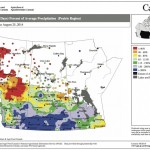
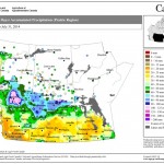
This map shows the total amount of precipitation that has fallen across the Prairies during the 30 days ending Aug. 25, as a percentage of the average expected for this period. This map seems to be a continuation of the maps we’ve seen so far this summer, with above-average amounts of rain over southern Alberta, Saskatchewan and western Manitoba and below-average amounts over northern Alberta.

Late summer/early fall weather

Issued: Monday, September 1, 2014 · Covering: September 3 – September 10, 2014

Last week’s weather ended up following its own rules as a relatively fast-flowing pattern developed across our region, bringing with it rapidly changing weather conditions. For this forecast period it looks like this weather pattern will persist. High pressure that started off this week will quickly be replaced by an area of low pressure that


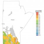
This WeatherFarm map shows the total amount of precipitation across agricultural Manitoba from May 1 through to Aug. 16. The Interlake region has been the driest during this period, with far-western regions seeing fairly wet conditions. The wettest area during this period was in the southern Red River Valley, which received over 500 mm of rain.

Warm and muggy, followed by cool and wet

Issued Monday, August 18, 2014. Covering August 20 – August 27, 2014

It looks like our weather pattern will undergo some changes over the next week or two. This forecast period will start off on the warm side, but by the weekend temperatures could be getting fairly cool. Don’t worry; it doesn’t look like summer is finished just yet. By Wednesday of this week the weather models

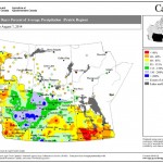
This map shows the total amount of precipitation that has fallen across the Prairies compared to historical averages over the 30 days ending Aug. 7. You can see just how dry it’s been across nearly all of agricultural Manitoba during this period; the only wet area was around The Pas. Farther west, much of northern and western Saskatchewan was wetter than average, as was east-central Alberta.

Off to a warm and dry start

Forecast issued Aug. 11, 2014, covering the period from Aug. 13 to 20, 2014

Only problem with last week’s forecast was that we saw two cold fronts move through last weekend instead of just one. The first moved through Saturday, bringing a few quick-moving thunderstorms. The second moved through on Sunday, bringing scattered clouds, the odd shower and cooler temperatures. Hopefully the forecast for this week will be as


photo: DANIEL BETZE

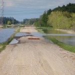
Opposition seeks high ground as flood waters recede

Manitoba’s opposition party wants action on flood mitigation 
but is a little shallow on details

There are some muddy politics swirling around Manitoba’s flood waters. On July 30, Manitoba’s opposition Tories called for a moratorium on drainage in both Saskatchewan and Manitoba, as part of a Progressive Conservative plan to reduce flooding. Tory water critic, Shannon Martin said he had asked “the province to engage our counterparts in Saskatchewan to

This map shows the total amount of precipitation that fell across the Prairies during the 30 days ending July 31 — only one day shy of the monthly total. Most of agricultural Manitoba was fairly dry during this period, with most areas seeing less than 40 mm. Extreme southeastern and northwestern areas were a little wetter. The wettest parts of the Prairies were over northern agricultural Saskatchewan and northeastern Alberta, especially around Edmonton, where an upper low brought large amounts of rain.

High pressure and plenty of sunshine

Forecast issued Aug. 4, 2014, covering the period from Aug. 6 to 13, 2014

Last week’s forecast worked out pretty much as expected. The weak system anticipated to move through late in the weekend was a little quicker than expected and as a result, less cool air was pulled in behind the system. This gave us warmer weather over the last part of the long weekend. This forecast period