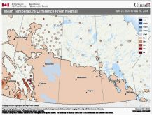
This forecast period begins with a continuation of the warm, dry weather we’ve been seeing off and on now for nearly two weeks. This warm weather, which has been bringing temperatures a good 6 to 10 C above the long-term average, looks to continue for at least a few more days before more average late-October temperatures move back in.
A large area of low pressure sitting in the Gulf of Alaska has been helping to build a significant ridge of high pressure over central North America. This in turn has been giving us mainly sunny skies and mild temperatures. Energy from this low is expected to move on shore late this week, generating an area of low pressure, forecast to track across the northern Prairies over the weekend. As this low passes by on Saturday we’ll see a weak cold front sag southward sometime late in the day, bringing with it slightly cooler temperatures.
Read Also

Why is the sky blue?
The colour of the skies, on the Prairies and elsewhere, tells the story of the paths sunlight takes as it enters Earth’s atmosphere, Daniel Bezte writes.
The main impact this low will have is that it will break down the upper ridge of high pressure, allowing energy from the Pacific to move inland and take a more southerly route. The weather models are showing the first piece of energy pushing through late on Sunday and into Monday, bringing with it clouds and showers along with fairly windy conditions. Temperatures don’t look like they’ll get that cold behind this system as a second system is forecasted to begin building to our west early next week.
This second system will help pull in some more mild air ahead of it from Tuesday through to Thursday of next week. Once again, I wouldn’t be surprised if we see daytime highs at or above the high end of the usual temperature range for this time of the year.
Usual temperature range for this period: Highs, 2 to 15 C; lows, -7 to 2 C. Probability of precipitation falling as snow: 30 per cent.