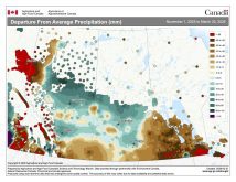
I don’t think anyone could have predicted just how strong the western ridge of high pressure, or the “heat dome,” would become in our last forecast period. The ridge dominated the weather and, due to the strength of the ridge, moved slower than forecasted. This kept our region mostly dry, with temperatures going from warm to hot before returning to more “normal” values late in the forecast period.
The big question for this forecast period is, what are the odds of getting any significant rain? We will begin this period with at least a chance of some rain, as the models show an area of low pressure developing to our southwest on Wednesday, then pushing northeast on Thursday and Friday. This will place us in a warm and humid southerly flow. Expect daytime highs to push back into the low 30s, with overnight lows only dropping into the upper teens. The best chance for rain, mostly in the form of thunderstorms, looks to be late Thursday and into Friday.
Read Also

VIDEO: Here’s Manitoba’s 2026 spring storm forecast
Weather models are calling for above-average precipitation in southern Manitoba, with at least two more Alberta clippers possible.
Over the weekend high pressure will begin to build back in from the north. This will cool us down a little bit, dropping our highs back into the mid-20s. Humidity levels will also drop, allowing for cooler overnight lows. This area of high pressure looks as if it will stick around for at least the first half of next week (July 12-15). This should result in a continuation of above-average temperatures, slowly climbing back toward the low 30s for highs. High pressure and warm temperatures will also mean little to no rainfall.
Looking further ahead, the weather models hint at the rebuilding of an upper ridge which could bring a return of very hot weather by the end of the week. Luckily, that is a long way off, so plenty can change before then.
Usual temperature range for this period: Highs, 22 to 31 C; lows, 10 to 17 C.