Warmest temperatures of the year expected

Issued: Monday, Mar. 9, 2015 – Covering: Mar. 11 – Mar. 18, 2015

After watching the weather models try to figure out the forecast for the last week or so, you can definitely tell spring is trying to move in. As warmer weather begins its annual battle with winter, the weather models often have a hard time agreeing on just what will happen. This is exactly what’s been

Drew Lerner, meteorologist

Forecaster sees a ‘drier bias’ this season

But Lerner cautions that he predicted the same last year

While much can still change, parts of Manitoba may be en route to a drier spring and summer. Speaking to producers during CropConnect in Winnipeg, Drew Lerner of World Weather Inc. said “what we’re going to be looking at this year is probably a little bit higher potential for a drier bias.” After years of


One last shot of arctic air

Issued: Monday, Mar. 2, 2015 – Covering: Mar. 4 – Mar. 11, 2015

It looks like this forecast period will be a transition period, as the weather models have been showing a switch in our weather pattern towards a much more spring-like one. This forecast period will start off much like all the forecasts for the last month, with an area of arctic high pressure dropping southeastward. This

Arctic high pressure continues to dominate

Issued: Tuesday, Feb. 17, 2015 – Covering: Feb. 18 – Feb. 25, 2015

Our weather over the last week was dominated by arctic high pressure as predicted, but those highs didn’t track quite the way the weather models indicated they would, resulting in only a mediocre forecast. This issue’s forecast begins where last week’s left off — with cold arctic high pressure dominating. The first and strongest of


Typical mid-winter weather

Issued: Monday, Feb. 9, 2015 – Covering: Feb. 11 – Feb. 18, 2015

It’s turning out to be quite the battle between cold air to our north and east and warm air to our west and south. Unfortunately, for those hoping for a return to mild melting weather, it looks like we stay on the cold side of things at least for the next week or two, as

Weather models having trouble agreeing

Issued: Monday, Jan. 26, 2015 – Covering: Jan. 28 – Feb. 4, 2015

Last week’s weather pattern played out pretty much as expected. As anticipated, the timing and exact paths of the lows coming out of the northwest were a little off, with the first low that moved through late last week taking a much more westerly route. Weather models have done a pretty good job with the


Milder weather should win out

Issued: Monday, Jan. 17, 2015 – Covering: Jan. 21 – Jan. 28, 2015

The fragile weather pattern I talked about last week seems to have stabilized for the time being, which means more nice winter weather ahead. For this forecast period, we’re kind of caught between well-above-average temperatures to our west, thanks to a strong area of low pressure off the coast of Alaska combined with a ridge

Weather pleasant but a little fragile

Issued: Monday, Jan. 12, 2015 – Covering: Jan. 14 – Jan. 21, 2015

The start of this forecast period will see the last in a series of cold arctic highs push off to the east, which should result in milder conditions for the remainder of this forecast period and hopefully beyond. The best way to describe this forecast period is fragile. That is, while there are a couple


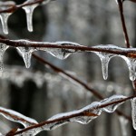
Small Icicles Hanging From a Branch

Cold, wet spring for 2015

If forecasters have it right, this winter could be another long one, 
but it won’t see long periods of below-normal temperatures

Call it an intermission from winter if you will, but don’t expect the warmer-than-usual temperatures to last — at least not in Manitoba. Speaking at Farm Credit Canada’s Ag Outlook in Winnipeg last week, meteorologist Mark Robinson said that this year’s El Niño is a weak one. “Right across the country we’re seeing warmer-than-normal temperatures,”

A northern low, just in time for Christmas

Issued: Monday, Dec. 15, 2014 – Covering: Dec. 17 – Dec. 24, 2014

The warm weather moved in as expected during the latter half of last week, but a strongly stratified atmosphere kept the really warm air from mixing down to the surface. Combine this with some low-level moisture and you end up with plenty of clouds and fog that helped to keep temperatures cooler than predicted. Temperatures