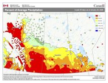
See what happens when you take a couple of weeks off from forecasting? We go from nice, mild, above-average temperatures to bone-chilling, well-below-average cold. While the change in weather pattern that took place over the holidays did result in cold weather, it also brought some much-needed precipitation. The questions for this forecast period are: Will the cold air continue? And will we see more snowfall?
To answer the first question, it looks like we are going to see a bit of a reprieve from the cold weather, with average to even slightly above-average temperatures expected for much of this forecast period. After a return to mild temperatures last weekend and into the early part of this week, the weather models show the really mild weather lasting until at least Friday or Saturday. Expect daytime highs in the -5 C area with overnight lows falling to around -15 C. There is a chance of some snow on Friday as a disturbance quickly drops southeast from central Alberta. Due to the expected speed of this system only light amounts of snow are expected.
Read Also
Forecasting spring 2026 weather on the Prairies
What weather can farmers expect across Manitoba, Alberta and Saskatchewan as they head into seeding? Plus: a lesson on what makes the seasons turn
Once this system slides by, we will see cooler air move in as arctic high pressure builds southeastward. Expect daytime highs over the weekend to be around -15 C with overnight lows falling to around -24 C. The weather models begin to deviate from each other by the end of the weekend. The Canadian weather model has our flow becoming westerly for the first half of next week (Jan. 17 to 19) which would keep us dry with near-average temperatures. The U.S. weather model has another area of low pressure dropping southeastward late on Sunday, followed by a reinforcing shot of cold air thanks to an area of arctic high pressure which is forecast to build in behind this low.
Looking further ahead, our general colder-than-average temperatures look to continue, with only a small chance for measurable precipitation.
Usual temperature range for this period: highs, -23 to -6 C; lows, -34 to -15 C.


