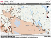
Last week’s forecast played out pretty close to what was expected. The warm air moved in by late in the week, bringing record temperatures to many areas, and the cold front came through a little earlier than expected, bringing with it a return to more seasonable values.
This forecast period will begin with a fairly strong area of low pressure anticipated to develop to our southwest, then track fairly quickly to the northeast. As the low pulls northward it will bring up some mild air Wednesday, but we’ll also see plenty of clouds and showers or periods of rain, all of which will help to keep temperatures down a little bit. With the clouds and rain we should expect to see highs in the upper teens on Wednesday. As the low moves northward it will drag down a cold front sometime Thursday, bringing clearing skies and cooler temperatures. Depending on the timing of the cold front, Thursday might not be that cool, but by Friday highs will likely struggle to make it into the low teens.
Read Also

How Earth evens out the energy input
Earth has surpluses of radiation in its equatorial regions, and deficits toward its poles. Our weather is a matter of Earth trying to even out the imbalance, Daniel Bezte writes.
Over the weekend, temperatures look like they’ll warm up a little bit as a weak low passes by to our north and our winds become southerly. Expect high temperatures to be in the mid- to possibly upper teens, under what looks to be plenty of sunshine. We could see a few clouds Sunday as the weak low slides by, but it doesn’t look like we’ll see any precipitation from this system.
Next week looks as if our weather will be more active as the general flow becomes more northwesterly. Several lows are expected to drop southeastward in the flow, bringing a mix of sun and clouds along with scattered showers on most days. High temperatures should be in the low teens depending on cloud cover, with overnight lows in the 0 to 4 C range.
Usual temperature range for this period: Highs, 9 to 19 C; lows, -2 to 7 C.