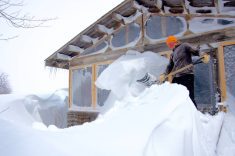
Once again, last week’s forecast did a pretty good job with the major weather features. We saw a nice warmup last week with a few locations breaking record highs last Tuesday and Wednesday. Then the weather models predicted a storm system over the weekend, and as I write this on Friday, it looks like that storm system is going to happen, just a little further west than first anticipated.
That leads us into this forecast period, and what could be a tough forecast, at least temperature-wise. As you might know by now, I used to write this forecast on Monday morning, just two days ahead of when you would read it. Now, due to publishing deadlines, I write this forecast-on Friday morning, which is a good five to six days ahead of when you read it. The problem with this forecast is the storm system that should impact our region over the weekend (Nov. 7-8). Areas that see significant snow will be cold and those that miss out, well, much warmer. Since I do not know where the snow will fall, I will have to rely on what I think will happen.
Read Also

June brings drought relief to western Prairies
Farmers on the Canadian Prairies saw more rain in June than they did earlier in the 2025 growing season
On Wednesday, the models show an area of high pressure to our north with a weak area of low pressure to our south. This will result in sunny to partly cloudy skies, with light to moderate westerly to northwesterly winds, and temperatures running right around the midpoint of the usual temperature range for this time of the year — a little warmer if there is no snow on the ground. By Friday or Saturday, extreme southern regions may see some light snow as an are of low pressure slides by to our south.
The next chance for snow will be Monday as another weak area of low pressure pushes through the Dakotas. Temperatures look to remain seasonable, with no strong pushes of cold air expected. The best chance for snow looks to be around next Wednesday or Thursday (Nov. 11-12) as a slightly stronger area of low pressure tracks a little further north. As usual, that is a long way off, so confidence in this system is low.
Usual temperature range for this period: Highs, -6 to +6 C; lows, -15 to -2 C. Probability of precipitation falling as snow: 75 per cent.