Maybe it’s because I’m getting old, but it seems like at the start of every new month I can’t believe how fast the last month went by. That’s right, we are already into the second month of 2023, and that means it’s time to look back at January, then redo our look ahead to see what the latest long-term outlooks call for.
Well, unless you stayed inside in January, you probably realize it was a warmer-than-average month. These warmer-than-average temperatures were found not just across Manitoba, but also in Saskatchewan and Alberta. In fact, it has been a while since I’ve seen such uniformly above-average temperatures right across the Prairies.
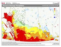
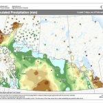
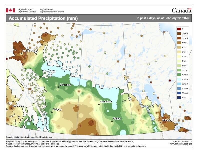
Let’s begin our look at January in the west. Alberta saw the warmest temperatures in January both absolutely and relatively. Calgary, not surprisingly, was the warmest place across the Prairies, with a mean monthly temperature of -3.3 C, which was about 3.4 C above average. Edmonton saw a mean monthly temperature of -8.9 C, which comes in around 3.2 C above average. Further north in the Peace region it was a little colder, with a mean monthly temperature of -9.8 C. This region typically sees much colder Januarys compared to its southern neighbours, but compared to average, it was the warmest region across the Prairies, coming in around 5.6 C above its long-term average. Looking at January’s precipitation across Alberta, northern and central regions came in well-below average, with the southern regions coming in near average.
Read Also
How Earth evens out the energy input
Earth has surpluses of radiation in its equatorial regions, and deficits toward its poles. Our weather is a matter of Earth trying to even out the imbalance, Daniel Bezte writes.
Moving eastward into Saskatchewan, both Regina and Saskatoon reported mean monthly temperatures in January right around -12.5 C. Comparing this to the long-term average we find Regina came in about 2 C warmer than average and Saskatoon, being further north, came in a little over 3 C warmer than average. Precipitation for both regions was well-below average, with average amounts coming in at around five mm of water-equivalent precipitation.
Next up is our home ground of Manitoba. Conditions across our region were, for the most part, like those of Saskatchewan. Both the Winnipeg and Dauphin regions saw mean monthly temperatures of between -13 and -14 C, which for these areas was about 2.5 C warmer than average. Brandon was the cold spot, both relatively and absolutely, with a mean monthly temperature of -15 C which, while colder than the rest of the Prairies, was still 1.5 C warmer than average. Precipitation across Manitoba was remarkably similar across all three regions, with amounts falling between five and seven mm of water-equivalent precipitation. These amounts were well below the long-term average of between 15 and 20 mm.
Of interest, one thing you have probably already noticed is that Alberta typically sees the warmest January, followed by Saskatchewan, then Manitoba. We will eventually cover this in our meteorology classes, but it has to do with us being in the centre of the continent and how the Rocky Mountains help to guide and funnel arctic highs into our region.
Who called it?
Overall, it was a warmer, bordering on a much warmer-than-average, January, and with the exception of Calgary, it was a drier-than-average month as well. Looking back at the various January forecasts, it looks like this month’s winner is… a three-way tie! The CFS and CanSIPS models both called for a warmer-than-average January with near-average precipitation. They both called for the warmest readings to be over eastern regions with the coldest readings in the west, so they got that backward. For my forecast I agreed with these two models, but didn’t differentiate between eastern and western regions, though I did say precipitation would more than likely be below average. So, does that give me the win over the other two? I will leave that up to you.
Now, on to our February and March outlooks. As usual, we’ll start off with the almanacs: the Old Farmer’s Almanac calls for a cold and snowy February followed by a warm and snowy/rainy March. The Canadian Farmers’ Almanac, in its usual cryptic way, appears to call for near- to slightly below-average temperatures in February along with above-average precipitation as they call for storms or snowy weather several times in the month. March looks like it will see near- to slightly above-average temperatures as it mentions fair weather and wet/rainy conditions. From this it looks like precipitation will be near to above average.
On to the different weather models. Starting with the U.S. NOAA and extrapolating its forecast northward, it looks like it calls for below-average temperatures and above-average precipitation, with western regions of the Prairies being the coldest and snowiest. Next on our list is the reliable CFS model. Its latest forecast calls for a warmer-than-average first half of February followed by a relative cooling trend toward well-below-average temperatures in March. Precipitation is forecasted to be near average. The CanSIPS model calls for slightly below-average temperatures in both February and March along with near-average precipitation.
To wrap up our long-range outlook, I looked back over the last 20 years to see how February and March played out when we saw a warm January. Over this period, we experienced 10 years with above-average Januarys. There was pretty much an even split between cold, average, and warmer-than-average Februarys, but in March the numbers leaned strongly toward average to above-average temperatures. Most Februarys were drier than average in years following a warm January, with March almost equally split between dry, average and wet. If I was to go with these values and put my gut instinct into it, I’d say February will turn out to see near-average temperatures and below-average precipitation. March is a tough one, but I am going to go with above-average temperatures and precipitation — mostly because I want March to be warmer than average.
Next issue we will get back to our “basically free” online meteorology class and look into solar energy — the driving force behind nearly all our weather.


