
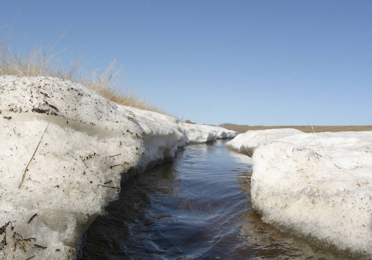
With the recent Alberta clipper dropping a heavy blanket of snow on southern Manitoba on April 8, a second one could be on deck as soon as this week.
Some parts of southern Manitoba got a renewed shot of winter snow April 14. Various mixes of rain and snow were also in the forecast later in the week, with the balance skewed heavier towards snow in the Interlake and western Parkland.
Read Also
Manitoba winter 2025-26 outstays its welcome
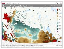
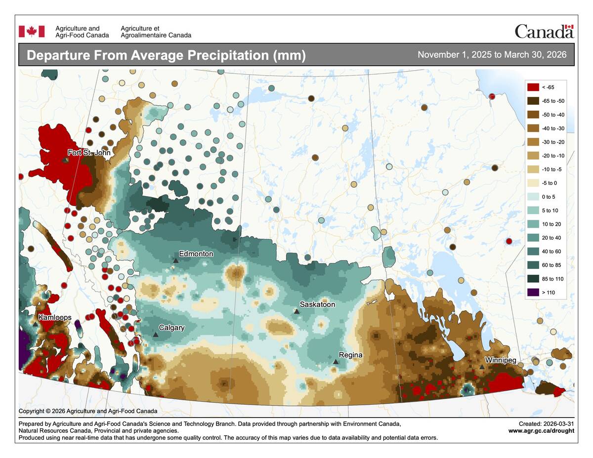
March ran 2 to 3 C below average across central Saskatchewan and southern Manitoba, capping a winter that was drier than normal nearly everywhere but Calgary.
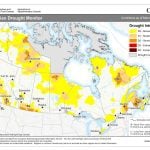
On April 7, the Province updated its flood forecast to indicate an elevated risk for the Interlake region. It updated the flood forecast again on April 11.
WHY IT MATTERS: Manitoba’s not totally done with snowfall yet, according to the weather forecasts and recent snow.
The initial flood forecast was updated to account for snow from a previous clipper that fell in the same region across Saskatchewan and into the northern part of agricultural Manitoba.
Given the increased risk of flooding in some of these parts of Manitoba, what does the near future look like for increased precipitation?
“Precipitation forecasts are tough beyond two weeks,” said Daniel Bezte, weather columnist for Glacier FarmMedia.
But in saying that, the weather models that Bezte uses to make his forecast are calling for above average precipitation across southern Manitoba over the next two weeks.
Is there a likelihood that more Alberta clippers could develop and upset the current flood forecast?
Based on what Bezte was seeing in weather models at the time of interview, there was a chance for at least two more Alberta clippers to drop more precipitation on agricultural Manitoba.
“We’ve seen quite a few,” said Bezte. “They seem to be coming every seven days for at least the last month and that main pattern hasn’t changed.”
What’s in a name?
So is there a seasonality to Alberta clippers? Yes and no.
“We can see them develop at any time of year,” said Bezte, “but they are a higher likelihood in the winter and the two shoulder seasons.”
Because cold air tends to sag south, the main area of the storm follows. The opposite tends to happen in the summer as that colder air is pushed north.
So once the season shifts to summer, will Alberta clippers remain on the radar?
“An Alberta clipper and a Colorado low, they’re basically the same system,” said Bezte. “One forms in Alberta, one forms in the U.S.”
Given the time of year, Bezte said that weather patterns are soon to shift in favour of Colorado low development over Alberta clippers.
Manitoba in storm bullseye
How either system forms boils down to the geography of North America.
“With the air coming in off the Pacific, it gets squeezed between top of the atmosphere and the mountains,” adds Bezte. “It actually gets quite complicated.”
Air coming off the mountains causes rotation to develop and spin up low atmospheric pressure. Once these lows develop, if they can tap into moisture they can become stronger.
In southern Manitoba in particular, Alberta clippers tend to develop in Alberta and dive southeast, whereas Colorado lows develop and come northeast.
“So they’re always aimed at Manitoba,” said Bezte, “so we tend to see more precipitation because of that.”