The Manitoba government is raising the alarm about potential flooding in the central Interlake region and Parkland.
Manitoba Transportation and Infrastructure’s Hydrologic Forecast Centre updated its spring flood outlook on April 11 to show increased flood risk in the Icelandic River and Fisher River basin.
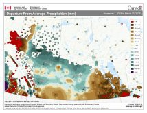
Snow pack double the average
Read Also
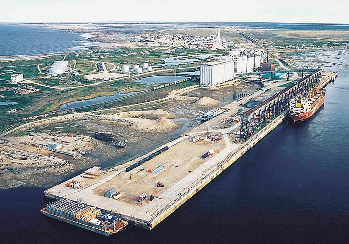
Manitoba, Ottawa sign deal to fast-track projects like Port of Churchill expansion
Manitoba and Ottawa have signed a regulatory streamlining agreement that names the Port of Churchill expansion as a priority infrastructure project.
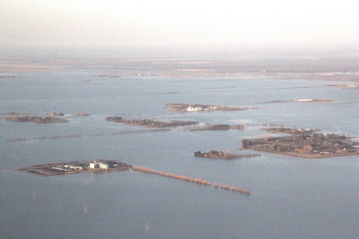
Snow surveys have come back with some of the highest melt potential in years. The snow water equivalent around Fisher River was measured at approximately 113 millimetres, double the long-term average and at least equal to levels observed in previous flood years.
Recent snowfall and anticipated late-spring runoff have brought a high risk of flooding to the Icelandic River, which could also be caused by ice jams.
Peak flows are expected to reach levels similar to those in 2014, but if the melt happens faster, flows could approach levels seen in 2022, which — bolstered by a line of Colorado lows that built up snow pack levels and complicated calving — were two feet higher than in 2014.
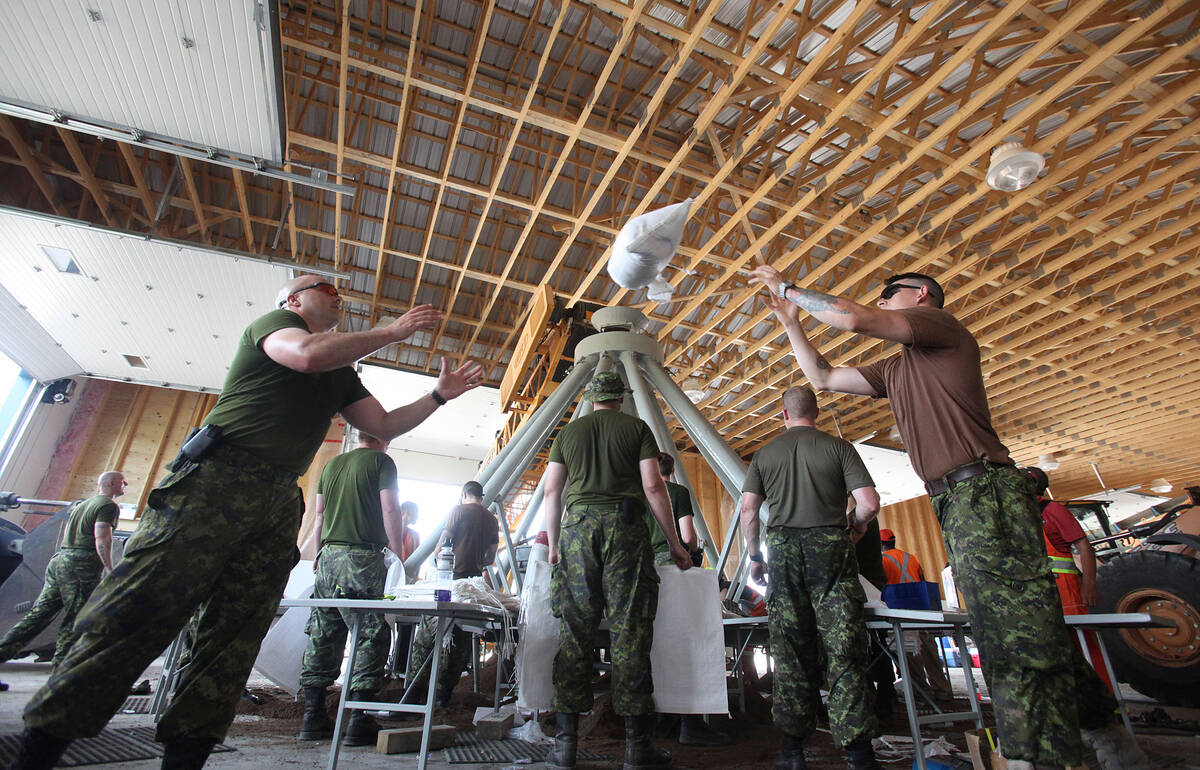
As a result, the province has arranged for tens of thousands of sandbags as well as volunteers to be sent to Peguis First Nation and surrounding communities.
In the Parkland, the province has flagged an increased risk of overland flooding as temperatures exceed 10 C this week.
“The elevated risk is due to significantly above‑normal snow pack, a delayed spring melt and an increased likelihood of rapid runoff combined with spring precipitation,” the latest flood outlook says.
Another storm coming?
A moderate flood risk remains for portions of the Red, Assiniboine, Souris, Saskatchewan and Carrot rivers. There is a low risk for tributaries of the Red and Assiniboine Rivers as well as the Winnipeg River basin in eastern Manitoba.
Parts of central Manitoba could see between 15-30 centimetres of snow on April 15, while southern Manitoba will see a thaw with high temperatures potentially reaching 16 C, said Environment and Climate Change Canada. However, that heat will be followed by rain showers the next day.