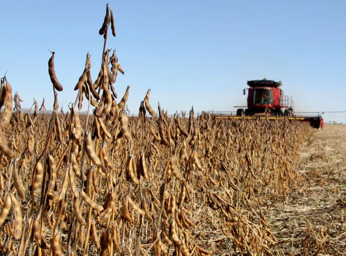
After spending the last few columns examining the main factors that may influence the coming winter, it’s time to bring everything together and take a look at what forecasters are predicting for the season ahead. But before diving into the outlook, let’s briefly review how October unfolded across the Prairies.
Normally, I would present the full set of weather data, but due to a change in publishing frequency, we’ll return to a more general summary format.
Warm in Manitoba
Read Also

Why is the sky blue?
The colour of the skies, on the Prairies and elsewhere, tells the story of the paths sunlight takes as it enters Earth’s atmosphere, Daniel Bezte writes.
October continued the pattern of well above-average temperatures that began in September. Across Alberta, mean monthly readings were about 1.0 C warmer than normal, increasing to roughly 2.0 C above average in Saskatchewan.
Manitoba was the warmest of the three provinces, with mean temperatures running 3.0 C to 4.0 C above normal. Winnipeg recorded the highest mean temperature at 8.7 C which was 3.7 C warmer than average, while Peace River was the coolest location, reporting a mean of 4.1 C, still 1.3 C above normal.
Fall rain builds water reserves
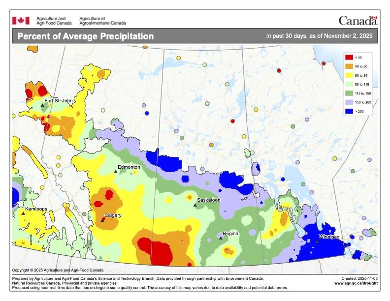
Precipitation told a different story. October was wetter than average across the southeastern and northern Prairies, with southern and eastern Manitoba seeing the greatest totals. These wetter conditions stretched northwestward through north-central Saskatchewan and into northeastern Alberta.
Winnipeg stood out as one of the wettest spots, recording 93.7 mm of precipitation, which was nearly 60 mm above the long-term average. North of Winnipeg, I measured over 135 mm at my own location, which made the month feel more like spring runoff than autumn rainfall, with ditches running full and pumps working overtime.
Further west and south, conditions dried out considerably. Regina reported just 28 mm for the month, while precipitation amounts dropped to near zero across parts of southwestern Saskatchewan and southern Alberta. The sharp contrast in rainfall across the Prairies highlights the uneven moisture patterns that continue to shape soil and field conditions heading into winter.
Winter forecast 2025
OK, now back to our winter weather outlook and the factors that may be controlling our winter weather. The early snowfall in Siberia and its influence on the Arctic Oscillation or North Atlantic Oscillation tends to lead to warmer- and drier-than-average winters across the western Prairies, with eastern regions seeing average to below average temperatures along with average to above average precipitation.
The same holds true for a warmer than average northern Pacific: warm dry west, cool wet east. So, if this was all we had to factor in, then I would say there is a pretty good chance this is what we would see this winter.
But there is a third, and in reality, a fourth player. The third player is La Niña, and while it is forecasted to be fairly weak, La Niña conditions often result in a colder-than-average winter across the Prairies with wetter-than-average conditions over western regions with near- to below-average precipitation over eastern regions. This goes against what the other two are calling for.
The last player is random chance and unexpected variations in global weather patterns. Different combinations of events, that on their own leads to a specific outcome, might combine to gives us something new. This is the difficulty in trying to predict long-term weather. While computer modelling has greatly improved forecasts out to 10 or so days, there has not been a huge change in our accuracy in our forecast’s months in advance.
Now let’s look at the different long- range forecasts or predictions and see what they are calling for this winter. Starting off with the almanacs, the Old Farmers’ Almanac is predicting that the winter will see above to well-above average temperatures along with near to slightly above average precipitation. The Canadian Farmers’ Almanac is calling for near- to below-average temperatures this winter and above-average precipitation.
The CFS model, which I find is one of the more accurate, is calling for near-average temperatures this winter with northern and northwestern regions transitioning into below-average temperatures as we work our way into the heart of winter. This model is calling for near-average precipitation across the eastern Prairies and above-average across the west.
Next up is the Canadian CanSIPS model, which is predicting above-average temperatures to start the winter with temperatures transitioning to near average values as we move into December and January. Their precipitation prediction is for a near average start to the winter right across the Prairies with western regions seeing above average amounts during the second half of winter.
The U.S. NOAA’s prediction, extrapolating northwards, appears to be calling for temperatures to start out around average and then transition to below-average. As for precipitation, they are calling for above-average amounts in the west with near- to above-average amounts in the east.
Last on the list of winter weather prediction is the European ECMWF model which is calling for near-average temperatures right through the winter. This is the first time in a long while that this model has departed from predicting above-average temperatures across our region. Their precipitation forecast is similar to most of the other predictions with western regions expected to see above-average amounts with eastern regions seeing near-average values.
If we look to see if there is any kind of consensus, we see a fairly equal split between above-, near-, and below-average temperatures. Precipitation on the other hand is strongly leaning toward near- and above-average amounts.
If I was to go out on a limb, I am leaning toward highly volatile winter temperature-wise with large fluctuations over the winter which will even out to near-average temperatures. As for precipitation, I have to go with the majority and say above-average precipitation with possibly the southern half of Alberta seeing near-average amounts.