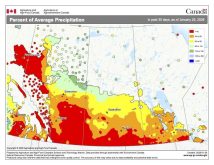
Once again, the overall forecasted weather pattern played out pretty well, but as always, the devil is in the details. The area of low pressure forecast to track through northern Manitoba last Thursday and Friday ended up taking a more southerly route, bringing significant March rains to a good part of southern Manitoba. Last weekend’s forecasted low ended up becoming much stronger and tracked farther north than initially forecast. This helped to bring in another shot of cold arctic air to start the week.
This forecast period begins with an arctic high sliding off to our southeast on Wednesday. Winds will become southerly and we should see temperatures rise back to around the freezing mark for highs. An area of low pressure is then forecast to quickly track through north-central Manitoba on Thursday. Extreme northern regions will see snow from this system, while southern and central regions will likely see a mix of rain, snow or even some freezing rain. Temperatures should be mild during the day Thursday, with highs expected to be in the +5 C range.
Read Also
Forecasting spring 2026 weather on the Prairies
What weather can farmers expect across Manitoba, Alberta and Saskatchewan as they head into seeding? Plus: a lesson on what makes the seasons turn
The weather models then show a Colorado low developing and lifting northeast through South Dakota and then moving eastward on Friday. Southeastern regions may see some rain or snow from this system, depending on the time of day it pushes through. As usual, we need to keep an eye on these types of storm systems, but for now, it looks like it will stay well to our south.
Slightly cooler air will move in over the weekend as arctic high pressure passes by to our northeast. The final part of this forecast has a low confidence level. The weather models keep trying to bring an area of low pressure across our region on Monday and Tuesday. The latest runs keep the main area of low pressure to our south, with only a few showers or periods of light snow affecting southern regions late on Monday and into Tuesday. Temperatures during this period look to be running near the high end of the usual temperature range for this time of the year.
Usual temperature range for this period: Highs, -7 to +6 C; lows, -19 to -7 C.


