Dry, hot weather expected

Weekly weather forecast

The biggest problem with last week’s forecast was that the low pressure system expected to zip through the region over the weekend ended up moving much slower. This allowed for several rounds of rain to form and rotate through our region, bringing too much rain to some areas and some much-needed rain to others. This

Get used to it?

Just as water and climate expert Bob Sandford began his keynote address at a Winnipeg conference about water management last week, he received a text from his son back home in Canmore, Alta. It was about a river gone wild. As Sandford spoke on the science of why weather patterns are becoming more turbulent, resulting


Take steps to adapt to climate change: Vilsack

Excerpt from a speech by U.S. Agriculture Secretary Tom Vilsack to the National Press Club in Washington, June 5, 2013. I’m the secretary of agriculture, and I am not here today to give a scientific lecture on climate change. I’m here to tell you what we’re seeing on the ground. We’re seeing more severe storms.

Big storms should stay away this week

While the weather across our region was relatively quiet last week, the weather pattern as a whole was not behaving quite like I predicted it would. Last week I pointed out that we were now into a summer pattern with weaker weather systems and more thunderstorms. We definitely saw more thunderstorms last week, along with


The ingredients of a tornado

After a fairly cool spring with few if any thunderstorms, summer has started to make headway into the Prairies over the last few weeks. In some years summers come and go with only the odd thundershower and maybe one big thunderstorm, but in other years every storm that comes along seems to bring severe weather.

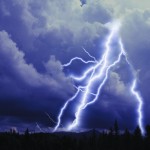
Lightning bolts coming from clouds

When thunder roars, stay indoors

Lightning strikes can kill

Lightning strikes every three seconds during the summer months in Canada. Besides causing power outages and forest fires, lightning strikes can also seriously injure or kill. Through recent advances in detection technology, Environment Canada’s Meteorological Service has improved its ability to track lightning and display high-risk lightning areas. See the new Canadian Lightning Danger Map


Seasonable temperatures ahead

Daniel Bezte's weekly forecast

Last week’s forecast played out pretty much as expected, with a couple of small but significant differences. The area of low pressure that affected southern and central regions on Thursday and Friday ended up being stronger than anticipated. This allowed for more cold air to work in behind the system, bringing fairly widespread frosts on

Green Gold (Central): Time to assess frost damage

Here is the first release for the scissor clipping project for 2013. This year we will be reporting from various areas of the province (eastern, central, Interlake, western). For the central report, the fields that are being sampled are in the south-central and Arborg areas. Site RFV PEAQ RFV NIR Height CP Arborg 268 212


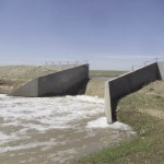
Provincial control structure on Tobacco Creek. photos: submitted

Reflecting on the flood that didn’t happen

After dire predictions and many preparations on both sides of the border, citizens have started breathing a huge sigh of relief. Unless we receive very large levels of precipitation in the coming days, the threat of flooding seems to have been alleviated. Some of us are just relieved; others are asking why the forecasts were

A wet few days ahead

It looks more and more likely that the second half of this week will be fairly wet across most of southern and central Manitoba. The main questions are just how much rain, where will it fall, and how long will it last? The weather models have been fairly consistent with developing another cut-off low over