
 After dire predictions and many preparations on both sides of the border, citizens have started breathing a huge sigh of relief. Unless we receive very large levels of precipitation in the coming days, the threat of flooding seems to have been alleviated. Some of us are just relieved; others are asking why the forecasts were so wrong.
Read Also

First Manitoba hay harvest short
Manitoba’s first hay cut of 2025 isn’t huge by initial counts, but things are worse farther west in the Prairies
The fact is that there are many variables affecting the flood forecasts that can impact total flows in our rivers and creeks. The obvious one is extra precipitation in the form of rain or snow. Some of the less obvious ones are the intensity of the run-off due to the speed of the melt, the moisture content of the snow, the amount of snow on the ground, the amount of moisture in the soil and the big factor this year, the amount of frost in the ground.
While many areas received rain last October before freeze-up, we also received relatively large volumes of snow cover before the cold weather hit, covering the ground with a blanket of protection against frost. The combination of lack of frost in the topsoil, and lack of groundwater in the subsoils left a surface that was able to absorb much of the run-off during snowmelt, alleviating much of the surface flow that could have created flood waters downstream from the dry fields.
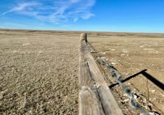
The unpredictability of the spring melt is further compounded by variable levels of snow on the ground. In the Red River Valley, many fields had less than a foot of snow on them by early April. From the escarpment west many of our fields had over three feet of snow on them right up until the third week of April. Snow loads in the treed ravines of the escarpment were even higher, and in the shade of the trees, slower to melt.
Not only was the snow unevenly distributed on the countryside, but not every inch of snow is equal in terms of moisture content. People often refer to a very “wet” snow, and in a sense they may be correct. Much of the snow that fell last winter was very crystallized and slow to pack, making the moisture content of the banks less than many other years for the height of the snow that was covering the ground.
Researchers from the University of Guelph have been working with the WEBS project on the South Tobacco Creek for a number of years trying to develop a computer model that will better predict run-off from the snow loads contained in the ravines. This is a variable that has confounded flood forecasting on both sides of the border, and can be responsible for significant levels of water moving downstream. Snow depth and density is much harder to measure in the uneven terrain and naturally forested areas of the escarpment.
Oddly enough, despite last autumn’s dry weather and low river levels, ice breakup was still an issue in many water bodies.
Data from the Tobacco Creek Model Watershed shows that snow depths exceeded four metres in some of the contained drains in the lower reaches of the creek. Fields that had blown clear of snow had deposited very deep banks within the stream bed itself.
When water barely over 0 C came in contact with the deep snow, instead of melting the snow, it refroze the water. This resulted in the creation of ice flows over 20 feet in diameter accumulating in the waterway and causing ice jams at bridges and culverts. One such jam held water back along PTH No. 23 from Jordan Siding back to the town of Miami. When the jam cleared, water held back was finally released and the rush downstream caused further blockages and flooding problems from Roland east.
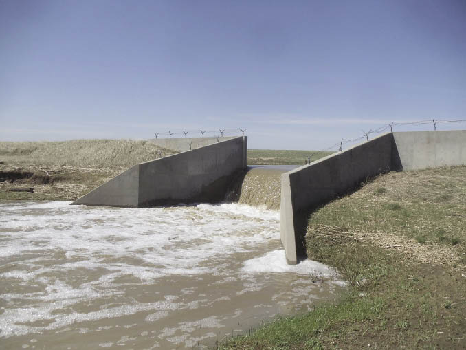
It is apparent that the water movement even without the threat of a serious flood could have been handled better. Road ditches are designed for drainage and are not suitable for long-term storage due to the need for a firm roadbed. But we could do a better job of metering the water down through our drainage systems.
Precipitation falls in varying levels on all areas of the province, so we can’t hold all of the flood waters back on the escarpment. We can, however, take another look at how that water moves down through the lower reaches of the watershed and look at new ways to restrict those flows once flooding threats have passed.
Storing water along PTH No. 23 for long periods of time would not be a feasible solution, but once the ditches have filled in a snowmelt event, those waters don’t have to be released at the full capacity of the culverts and bridges, we could limit those flows when levels drop below 60 per cent of ditch capacity.
Like a throttle in a hydraulic system, water could be managed through a series of notched weirs or other containment systems to reduce flooding damage in downstream areas, and increase water availability in the upper reaches of the watershed. Heavy rains during the May long weekend had a similar impact, but without the threat of ice jamming, was able to move unimpeded on its 4-1/2-day journey to the bottom of the watershed. By the end of August people could be once again looking for water, but we have already let it all flow on its way to Lake Winnipeg, nutrients and lost sediments included.
There are both fundamental similarities and differences between a snowmelt situation and a seasonal rain, but the need to deal with both situations is evident. Solutions are within our grasp, but until we start treating water as a valued resource instead of something to be drained away, we will continue to live in fear of the next drought, and the next flood.