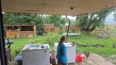
After a fairly cool spring with few if any thunderstorms, summer has started to make headway into the Prairies over the last few weeks. In some years summers come and go with only the odd thundershower and maybe one big thunderstorm, but in other years every storm that comes along seems to bring severe weather. If the early part of thunderstorm season is any indication, it looks like this could be one of the more active years.
Every year I revisit the topic of severe summer weather, and in particular, thunderstorms and tornadoes. The reason I do this probably has to do with my teaching background. Typically it takes three to five attempts for people to “learn” a topic and since we are dealing with such a potentially deadly topic I think the extra lessons to remind us are well worth it.
Read Also

Thunderstorms and straight-line winds
Straight-line winds in thunderstorms can cause as much damage as a tornado and are next on our weather school list exploring how and why severe summer weather forms.
The biggest question about thunderstorms and tornadoes is probably why some thunderstorms produce tornadoes and others don’t. The answer to this, and likely why I am always hesitant to write about how tornadoes form, is that we just don’t really know. We have a pretty good idea of the conditions necessary for the formation of tornadoes, and from this we can make some good, educated guesses, but until we can get detailed measurements of the atmosphere before and during a tornado-producing thunderstorm, the best we can offer is just that — an educated guess.
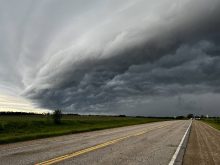
We know that for tornadoes to form you need severe thunderstorms, and not the garden-variety afternoon thundershower. The reason some thunderstorms are not severe while others do become severe comes down to a few factors. The first is just how much energy is available for the development of the storm. For thunderstorms, energy comes in the form of heat, and heat can be found in warm air temperatures or it can be liberated when water condenses. For most thunderstorms it is a combination of the two, but heat being released during condensation is the biggest source of energy — that’s why most storms occur on warm, muggy days.
The next factor that helps to determine whether a storm will become severe or not is wind. Now remember, the atmosphere is three dimensional, so when we talk about wind we are not just talking about wind at the surface, but also at different heights. In a garden-variety thunderstorm the wind doesn’t change much as you go up in height. This means that over time, the storm’s downdrafts wipe out or kill off the updrafts.
Separation
When this happens the storm no longer has an energy source and it begins to weaken and die. When wind speed or direction change with height, the updrafts and downdrafts can become separated, and in some cases the downdrafts will actually help the updrafts and strengthen them. When this happens there is a continuous supply of energy for the storm and the storm can remain strong and last for several hours.
Weather experts believe that it is this change in wind speed or direction with height, also known as wind shear, that is responsible for the development of tornadoes. Here is where it starts to get a little fuzzy, but this is how experts believe tornadoes form. If the change in wind speed and direction is just right within the storm, large parcels of air will begin to rotate. This is the same idea as when you take a pencil and spin it between your hands. If one of these rotating parcels of air gets caught up in the storm’s updraft, and the winds remain “just right,” it will begin to spin faster and faster, much like a spinning top. If the winds are not just right, then the air will not spin fast enough, and just like a spinning top, it will fall over and break apart.
Now, picture the spinning air becoming vertical within the updraft. The rapidly rising air within the updraft now begins to stretch out the spinning air and this will enhance the rotation, much like a figure skater pulling their arms in during a spin. As the spin rate increases it continues to stretch out, eventually breaking through the bottom of the storm. At this point we would see a funnel cloud. If it continues to stretch and increases its spin rate, the funnel cloud will reach the ground and become a tornado. How big the tornado will get then depends on either how big the area of rotation that started the tornado was, or how long the “just right” set of wind speed and direction remain within the storm.
While tornadoes can produce the most powerful winds on Earth and they can be truly awe inspiring to see, I really hope that no one has to feel the effects of one first hand. Let’s hope the rest of the summer brings us a good combination of sunshine, heat, rainfall, and yes, a few thunderstorms to add a bit of excitement.