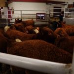
The 10-litre M6E-1 drone from American company HSE Unmanned Aerial Vehicles was one design tested by Baresich. The current cost of this drone, and its accompanying kit, stands at US$11,499. 

Spray drones take wing

Users say flexibility, lower costs key factors in growing interest – despite technological and regulatory limitations

Drones are now being used for spray applications in countries around the world. And while not commercially commonplace in Canada yet, companies and ag-service providers continue investing time and resources in the technology. Despite ongoing technical issues and unanswered practical questions, some think sprayer drones can bring a variety of agronomic, health, and human resource

Today’s drones are great at selecting pastures and tracking cattle, can read an ear tag from 70 metres up, and offer spectral imaging a hundred times more powerful than 
satellites, says researcher John Church. And while they’re not good at herding, drone technology is close to offering health assessments of individual cows.

Plunging prices and better tech should put drones on your radar

Drones with sophisticated imaging tech can be robust precision tools for managing cattle on pasture

Producers are always being pitched new technology, and the marketing din is arguably louder than ever in this age of precision agriculture. So when producers ask if unmanned aerial vehicles are just expensive toys, it’s a fair question. While John Church would be the first to admit he has a lot of fun researching the


Farmers have newer and simpler rules for incorporating drones into their operations.

New federal drone rules will be a boon to farmers

Previous rules discouraged producers from using them to check crops and livestock

New federal rules for operating drones will make it a lot simpler for farmers to include them in their operations, says the president of a Winnipeg-based company that trains drone operators. Matthew Johnson, president and CEO of M3 Aerial Productions, said the move is a necessary one. “For a long time farmers have been testing


Farmers Edge is partnering with Planet, the company with the largest fleet of Earth-imaging satellites, to bring farmers satellite images of fields several times a week. (Submitted image)

Farmers Edge expands satellite imagery offering

Farmers Edge says it’s making satellite imagery a practical and affordable agronomic tool for farmers through a new strategic partnership with Planet, the company with the largest fleet of Earth-imaging satellites. “We think this will be game-changing,” Farmers Edge president and CEO Wade Barnes said in an interview Oct. 3. “I think it’s going to


Matthew Johnson of M3 Aerial Productions says a drone ground school will contribute to public safety while teaching operators how to fly the remote aircraft.

Brandon University launches new drone training

New course gives students opportunity to become certified drone pilots

Brandon University will be one of the first post-secondary institutions in Canada to offer an unmanned aerial vehicle (UAV) pilot ground school when it introduces a course credit for taking the program this fall. Pilot training schools now offer similar training but not university course credits. The new course will offer students everything they need


An unmanned aerial vehicle is used to check a wheat crop.


Is a drone right for your farm?

Uses can include evaluating plant stands, crop scouting and locating and counting livestock

Along with my agribusiness class, I watched, in considerable awe, the beautiful video images of the fields and facilities of a local seed company as they were projected on the classroom screen. The soundless video showed crystal-clear footage taken from an unmanned aerial vehicle (UAV), also called a drone. Two decades previously, my family received

Unmanned Aerial Vehicles offer great promise, but aren’t going to replace old-fashioned scouting just yet.

Boots on the ground must support scouting technology

The existing technology can detect variation in a field, but not why that variation exists

There’s no shortage of technology available to help researchers, agronomists, and farmers scout their fields. From satellite imagery and unmanned aerial vehicles (UAVs or drones) to smartphone apps, there are plenty of tools out there. Just don’t expect them to replace boots on the ground any time soon. The limitation of current remote-sensing technology, such