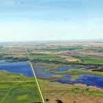
Summer flood bulletin #4

Province of Manitoba – Manitoba Infrastructure and Transportation advises that weekend rainfall across much of southern Manitoba has resulted in flooding and record flow levels on 13 southern Manitoba rivers and streams, washed-out roads and some localized evacuations. Tomorrow’s forecast calls for a high to severe wind warning for Lake Manitoba, the South Basin of

Souris River flooding north of Melita, Man.  

Province vows to tackle southwest’s water woes

A new study shows the link between unlicensed wetland drainage and stream flows

Heavy rainfall isn’t the only reason overland flooding is washing out roads and resulting in hundreds of thousands of acres left unseeded in southwestern Manitoba this year, provincial officials say. Manitoba Infrastructure and Transportation Minister Steve Ashton said last week the province now has proof illegal drainage in Saskatchewan is exacerbating the problems faced by


Flood bulletin #28: May 6

Province of Manitoba media bulletinWarnings and Advisories A flood warning is in place for all points along the Carrot River due to high flows.  The ice pack is moving but water remains high. A flood warning remains for the Assiniboine River from the Shellmouth Dam to Brandon, due to high flows. A flood watch is

Flood bulletin #27: May 5

Province of Manitoba media bulletinWarnings and Advisories Flood warnings are in place for all points along the Carrot River due to high flows and the potential for ice jams, and the Assiniboine River from the Shellmouth Dam to Brandon, due to high flows. A flood watch is in place for: – the Saskatchewan River at


FLOOD BULLETIN #26: May 2, 2014

Province of Manitoba media bulletin Warnings and Advisories Flood warnings are in place for the Assiniboine River from the Shellmouth Dam to Brandon, due to high flows. A flood watch is in place for: – all points along the Carrot River, due to high flows and the potential for ice jams; and – Brereton Lake

Flood bulletin #25: May 1

Province of Manitoba media bulletinSummaryBirdtail Creek Water was released yesterday from behind a culvert blocked by ice at the base of a former railway embankment near Birtle. The water reached Birtle yesterday, causing a 10-inch rise in water levels at the bridge on Centre Street.  Reports indicate there is approximately 1.5 feet of clearance under


Flood bulletin #22: April 29

Province of Manitoba media bulletin Summary Birdtail Creek Overnight, a large excavator cut through a section of a former rail bed to release water trapped behind a 30-metre-high embankment near Birdtail Creek and PTH 45. At this time, water levels are being monitored.  The effectiveness of the breach may be affected by the recent rainfall

Flood bulletin #18: April 28

Province of Manitoba media bulletin SummaryBirdtail Creek The former railway embankment with a frozen box culvert at its base holding back a significant amount of water near PTH 45 continues to fail. A second embankment slide has developed at the site. Water still appears to be seeping through the embankment as the downstream creek has


Manitoba flood bulletin #12: April 23

Province of Manitoba media bulletin Summary A substantial ice jam has formed at the Maryland Street bridge in Winnipeg, creating temporary elevated water levels.  It should clear within the next few hours. A rise in Netley Creek caused by ice jamming at the junction of the creek and the Red River resulted in the precautionary

Manitoba flood bulletin #11: April 22

Province of Manitoba media bulletin Summary The Red River has crested in Winnipeg. The forecast crest was 19 feet at James Avenue in Winnipeg. It reached 19.17 ft. at 2 a.m., elevated due to a surge in flows along the Red River when the ice released south of Winnipeg. The weather forecast calls for heavy