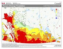
The strong storm system the weather models forecast last weekend to affect our region did materialize, but as usual with strong storms, it didn’t behave exactly as expected. Instead of coming in as one main system, it came through in waves of energy. It also took a more westerly and northerly track, which resulted in eastern Saskatchewan, western Manitoba and the central and northern Interlake regions seeing the heaviest amounts of rain.
For this forecast period it looks like dry weather will prevail for the most part, as high pressure tries to dominate. Pacific high pressure will begin building into our region on Wednesday, bringing sunny to partly cloudy skies along with above-average temperatures. Expect daytime highs to be in the upper teens, with overnight lows to be around +7 C.
Read Also
Forecasting spring 2026 weather on the Prairies
What weather can farmers expect across Manitoba, Alberta and Saskatchewan as they head into seeding? Plus: a lesson on what makes the seasons turn
By the time the weekend rolls around, the weather models show another large area of low pressure developing to our southwest. Our winds should become southerly on Friday and Saturday ahead of this low. Temperatures also look to be fairly mild, thanks to that southerly flow. Expect daytime highs to be around the 20 C mark; they may get even warmer, depending on the amount of sunshine on Saturday.
The weather models are currently tracking this low north-northeast through Saskatchewan on Saturday and then through northern Manitoba on Sunday. This should keep most of our forecast region dry, with only the odd chance of a shower or possibly a thundershower over the weekend. On Monday, as the low pulls off to the east, we’ll see a cold front push in from the northwest. This front will bring with it some showers and maybe the odd thundershower if it comes through late in the day. High pressure should build back in on Tuesday, bringing cooler temperatures.
Usual temperature range for this period: Highs, +9 to 21 C; lows, -1 to +8 C.


