As summer is slowly coming to an end, we are also coming to the end of our look at severe summer weather.
The two phenomena we’ll examine are often overlooked, but both have warnings and advisories associated with them — rainfall and humidity, or what is otherwise known as humidex.
Humidity, by its simplest definition, is the amount of water vapour that is in the air. The warmer the air, the greater the distance between air molecules and therefore, the greater the holding capacity of the air for water vapour. Due to this relationship, warm air has the capacity to hold much more water than cold air.
Read Also

VIDEO: Here’s Manitoba’s 2026 spring storm forecast
Weather models are calling for above-average precipitation in southern Manitoba, with at least two more Alberta clippers possible.
The most common way in which humidity is reported is relative humidity. Unfortunately, it is probably one of the most misunderstood terms used in trying to describe the weather.
Relative humidity is a ratio of the amount of water vapour that is in the air, compared to the maximum that it could hold under those same conditions, and is expressed as a percentage.
For example, if we had an air temperature of 10 degrees Celsius and had eight grams of water vapour per kilogram of air, our relative humidity would be 100 per cent, since air at 10 C can hold a maximum of eight grams of water vapour. If this same air was warmed up to a temperature of 30 C and the amount of water vapour in the air didn’t change, the relative humidity would now be around 29 per cent, as air at 30 C can hold 28 grams.
This is where the misunderstanding begins to develop. When the air temperature was 10 C and the relative humidity was 100 (per cent), people would say that it is humid out, but once the temperature has warmed up to 30 C and the relative humidity dropped to 29 per cent, people would say that it is very dry out, but in reality, the amount of water vapour in the air has not changed, only the temperature has.
A better way to measure humidity is by using the dew point temperature, which we simply refer to as the dew point. This measurement is a fairly simple way of telling us exactly how much moisture is in the air no matter how the temperature changes during the day. The dew point is the temperature that we would have to cool the air down to for condensation (or dew) to begin forming.
In other words, it is the temperature that the air would have to be to give us 100 per cent relative humidity. For example, if it is 18 C outside early in the morning and the dew point is 18 C, the relative humidity would be 100 per cent. By the afternoon, as the air warms up, the dew point would still be around 18 C if no additional water vapour was added or removed from the air, but the relative humidity would now have dropped into the 50 per cent range.
The best way to look at humidity and determine how humid it is outside is as follows:
Dew points that are less than 10 C, the atmosphere is fairly dry.
Dew points in the 10-15 C range are comfortable.
Dew points in the 15-20 C range are humid, starting to feel uncomfortable.
Dew points over 20 C are getting very humid, start to feel very uncomfortable.
Dew point over 25 C, extremely humid and conditions will be very uncomfortable and can even be dangerous.
This illustrates why dew point is a better measure than relative humidity. If the dew point was 25 C we know it is very humid out no matter what the temperature is, but if the temperature was, let’s say 35 C, the relative humidity would only be around 55 per cent. That would make some people think that it’s not very humid, despite the enormous amount of water the atmosphere held. So, remember, if it’s a hot summer day with dew points in the low twenties, even if the relative humidity is only 50 per cent, it is still humid.
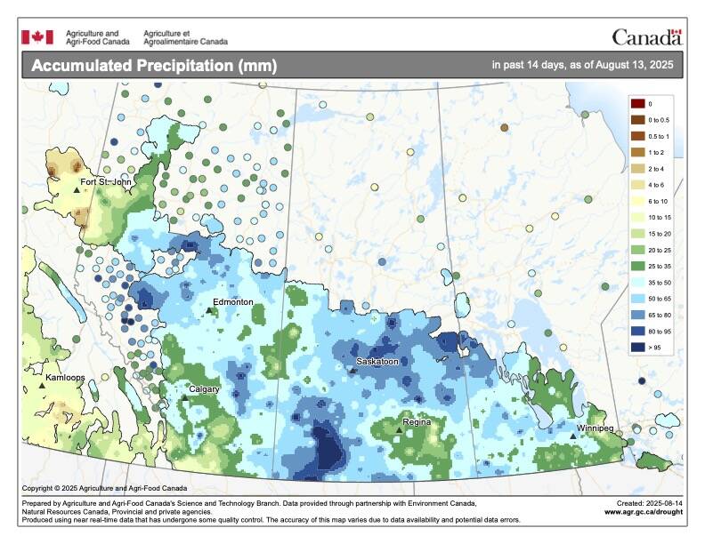
Now on to the one thing about severe summer weather that we tend not to think about until it creeps up on us — heavy or extreme rainfall.
When you look at the impact of heavy rain and the resultant flooding, it by far outweighs most of the other summer severe weather events.
Just what is a heavy or extreme rainfall event? According to Environment Canada rainfall warnings are issued according to the following criteria.
If it is going to be a short duration event, such as a thunderstorm, you need to expect upwards of 50 mm of rain in one hour before a rainfall warning will be issued, at least across the Prairies. It is actually lower over the east and west coasts. While this might not make sense at first, if you think about it, they rarely get the intense thunderstorms that the inland areas of Canada receive.
If the rainfall event is expected to be a longer-term event, then the criterion for a warning is when 50 mm of rain is expected within 24 hours or 75 mm of rain is expected within 48 hrs. Sometimes, due to the nature of summer storms, you can have both types of warnings going on at the same time.
If you listen to or read the news over the last couple of years, there has been plenty of talk connecting extreme rainfall events and global warming. It is not just the air temperature that is getting warmer but also the oceans. Combine warmer oceans with warmer air and you get an increase in atmospheric moisture levels, or humidity. This does not mean we will always see higher humidities but it does mean that the atmosphere can hold more water vapour and will receive more water vapour.
All this water vapour must go somewhere. If you remember the water cycle, the moisture in the air will eventually fall in some form of precipitation. The more water vapour available, the greater the chance the precipitation falling will be an extreme event.


