Where does the time go? Not only have we come to the end of another month, but also the end of climatological summer. That means it is time for a double look back at the weather — first for August, then for the summer.
We will begin in Manitoba and move westward across the Prairies. Also, thanks to a couple inquiries from readers, we will discuss temperatures from the point of how far above or below average and also in terms of actual values.
August weather across southern and central Manitoba was, for the most part, warm and relatively dry. The exception to this was eastern Manitoba starting around Winnipeg. Winnipeg’s mean monthly temperature of 19 C was 0.2 C above average, which would rank the month as being around average.
Read Also
Why is the sky blue?
The colour of the skies, on the Prairies and elsewhere, tells the story of the paths sunlight takes as it enters Earth’s atmosphere, Daniel Bezte writes.
As we move westward, the actual temperatures were not any warmer, but above-average values increased. For example, Brandon saw a mean monthly temperature of 18.7 C, which is about 1 C above average. Dauphin was the warm spot, with a reading that was 19.1, which puts its August at 1.4 C above average.
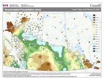
While temperatures were uniform in August, precipitation was not. Both the Brandon and Dauphin regions received between 25 and 35 mm of rain, which was about 30 to 40 mm below average. While most areas saw below-average amounts, thunderstorms did bring significant rain to some areas of western Manitoba. Further east, Winnipeg and most of eastern Manitoba saw more widespread thunderstorms. Winnipeg reported 115 mm of rain in August, which was about 40 mm above average.
Moving westward, the trend of warming temperatures increased. In Saskatchewan, Regina and Saskatoon reported mean monthly temperatures of around 19.7 C, nearly 2 C above average. Both regions reported about 45 mm of rain, which was about 25 mm below average. This trend builds as we move into Alberta. Edmonton and Calgary were the overall hotspots, with mean monthly temperatures right around 20 C, which was a good 4 C above average.
Further north, the Peace region saw a mean monthly temperature of around 18 C, which was 3 C above average. Rainfall ranged between 45 and 55 mm in the Calgary and Edmonton regions or about 25 mm below average. Peace River reported about 65 mm, which was about 15 mm above its long-term average.
Overall, it was a warmer- and drier-than-average August across nearly all of the Prairies, with western regions being the hottest. Looking back at predictions for the month, it appears all weather models were correct with the call for warmer- and drier-than-average conditions in August.
Season in review
Looking at the whole summer, mean average temperatures across the Prairies were surprisingly uniform. They ranged from a low of 16.6 C in Peace River to a high of 18.8 C in both Winnipeg and Edmonton. Across the rest of the Prairies, average summer temperatures came in right around the 18 C mark.
When comparing these to the long-term averages, summer in Manitoba and Saskatchewan was between 0.5 and 1 C above average, while in Alberta, the consistent summer heat combined with its normally cooler long-term averages resulted in a summer that was 1.5 to 3 C warmer than average.
Looking at precipitation over the summer, most areas saw below-average amounts, with only two of the main reporting locations recording above-average amounts: Winnipeg and Calgary. Winnipeg was the wet spot, with a summer total of 316.8 mm compared to an average of 235 mm. Calgary reported 225.7 mm, which was slightly above its average of 216 mm.
The dry spot was Regina, with only 90.3 mm of rainfall, which fell well short of its 183 mm average for summer. So, just like August, summer across the Prairies was, for the most part, warmer and drier than average.
As for the latest fall weather outlooks, we begin with the almanacs, which, as you may recall, struggled with the summer forecast. The Old Farmer’s Almanac calls for a cool and wet September followed by a warm October, with near-average precipitation.
The Canadian Farmers’ Almanac appears to call for colder- and wetter-than-average conditions for September and October, as it mentions wet, showery and even snowy weather several times.
Moving to the weather models, the CFS model is calling for above-average temperatures in both September and October, with near-average precipitation. The CanSIPS model is calling for above-average temperatures in September and October with below-average rainfall in September and near average in October.
Extrapolating NOAA’s forecast northward, it looks to be calling for near-average temperatures and precipitation this fall. The ECMWF weather model is also calling for above-average temperatures in both months, along with near- to below-average precipitation.
As with August, I am going to go with the weather model consensus of above- average temperatures along with near- to below-average precipitation. However this fall ends, I hope you get the perfect weather to end your year’s growing season.


