Earlier this summer, we went over atmospheric stability and instability and how this can lead to the development of thunderstorms.
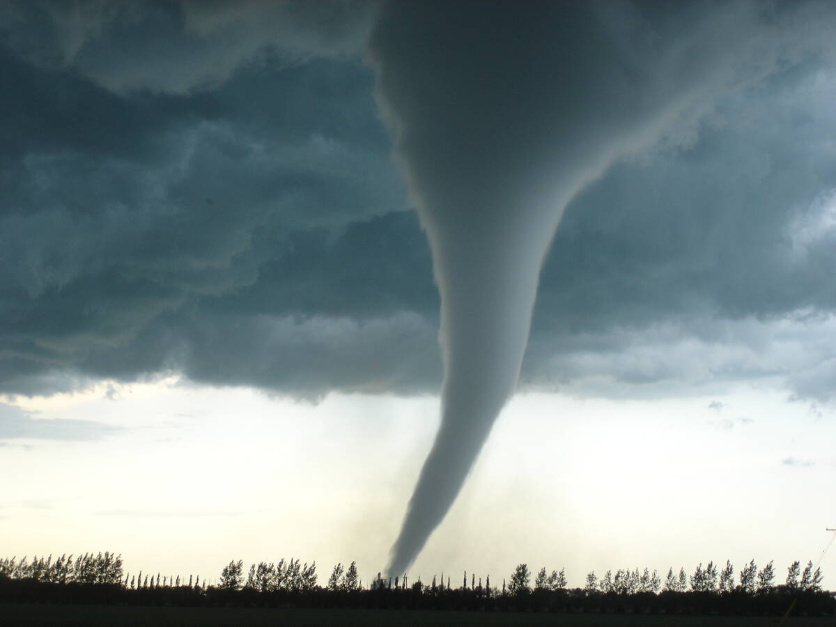
Now we turn our attention to the most destructive, yet awesome, weather event associated with thunderstorms — the tornado.
There are several different theories of how tornadoes form. That’s right — as good as our technology is, we are still not entirely sure just how tornadoes form.
Read Also

Why is the sky blue?
The colour of the skies, on the Prairies and elsewhere, tells the story of the paths sunlight takes as it enters Earth’s atmosphere, Daniel Bezte writes.
The theories that we will discuss are:
• Super cell theory.
• Rear-flank downdraft theory.
• Tornado vortex theory.
• Multiple vortex theory.
The first two theories are kind of tied together as they both involve supercell thunderstorms. To understand these two theories, we need to understand just what a supercell thunderstorm is.
As we already know, thunderstorms are fueled by the presence of warm, moist air near the surface and colder air aloft. What makes a supercell thunderstorm different from a regular thunderstorm is the ability for the storm to sustain a rotating updraft.
How these storms can rotate is a result of wind shear, or the change in wind speed and direction with height. As a supercell thunderstorm evolves and the updraft intensifies it draws in warm, moist air into the storm which helps drive further storm development.
With the right type of wind shear, the updraft becomes tilted which does two things. It helps to keep the updraft separate from the downdraft allowing the storm to continue growing, and secondly, the tilting start to stretch and squeeze the rotating column of air vertically, making the rotating air spin faster.
It’s this stretching and squeezing of the rising rotating column of air that researchers believe leads to the development of tornadoes, but the exact mechanism is still not fully understood.
This leads to the second theory of tornado formation and that is rear-flank downdraft.
As the supercell thunderstorm evolves, a region of cool, descending air develops on the backside of the storm. This is the downdraft that all storms have, but due to the wind shear titling, this downdraft does not come crashing down of the main updraft area. Instead, this downdraft is able to interact with the updraft by enhancing the low-level inflow and rotation which in turn can then be pulled up into the updraft of the supercell, leading to increased likelihood of the formation of a tornado.
Then there’s the tornado vortex theory, which is very similar to the supercell theory and builds on, or rather almost simplifies it. This hypothesizes tornadoes form when horizontal spinning air in the storm updraft is tilted vertically by a strong updraft. T
These rising columns of air, or updrafts can be moving very fast, and as the air rises, it stretches and tightens or contracts the rotating column of air, much like a figure skater pulling in their arms when spinning. This, just like with the figure skater, causes an increase in spin rate due to the conservation of angular momentum. This whole process is known as vortex stretching and the intensified spinning motion within the storm may then lead to the formation of a tornado.
Finally there is the multiple vortex theory. As the name of the theory suggests, the main vertex within a thunderstorm contains multiple smaller vortices rotating within the main circulation. These smaller vortices can appear as satellite tornadoes or as sub-vortices within the primary tornado. This phenomenon results in a tornado with a more intricate appearance, often displaying a spiral pattern of swirling winds within the main funnel.
According to the multiple vortex theory, the main column of rising, rotating air serves as the parent vortex and provides the circulation or rotation necessary for the formation of the tornado. As the parent vortex intensifies, it can then start to spawn smaller satellite vortices. These satellite vortices are typically found rotating around the main funnel cloud and this is often why we see unique and intricate structures in tornadoes.
The interactions between these satellite vortices can create a complex pattern as the individual vortices merge, split, and interact with each other. This can result in the rapid change in shape, size, and intensity of the tornado. This chaotic behavior can help to explain the erratic movement and characteristics we sometimes see in tornadoes.
How these satellite vortexes are formed is still not known.
It may be similar to the formation of areas of low pressure, and how they can randomly spin up along a boundary of opposite-moving air. Just picture the same thing happening, but on a much smaller scale and a much, much faster speed. The constantly changing environment within the storm, and the physical landscape the storm is travelling over, can cause these satellite vortices to spin up, grow larger, and then simply die away.
Personally, I think all the theories bring something to the table and as with most complex systems, it is probably a combination of some of all these theories that leads to the formations of tornadoes.
The one thing the theories have in common this the need for a strong, well-established thunderstorm that either has rotation or is in an environment where columns of air can gain rotation.
Hopefully as technology gets better, research will eventually lead to the definitive answer on the formation of tornadoes, and that in turn leads to better warnings.