I kind of blew it on last week’s forecast when I said we won’t see any significant snowfall. The arctic high that was forecast to drop southward over the weekend took just a little bit longer than expected to move. This allowed an Alberta clipper to take a much more northerly route, bringing a good swath of snow from western Manitoba southeastward.
This forecast period begins with a very strong and cold ridge of arctic high pressure. The models have this high drifting off to the south by Thursday, which will allow slightly warmer air to move in on Thursday and Friday. We should expect highs to be around -15 C, which is right around average.
Read Also
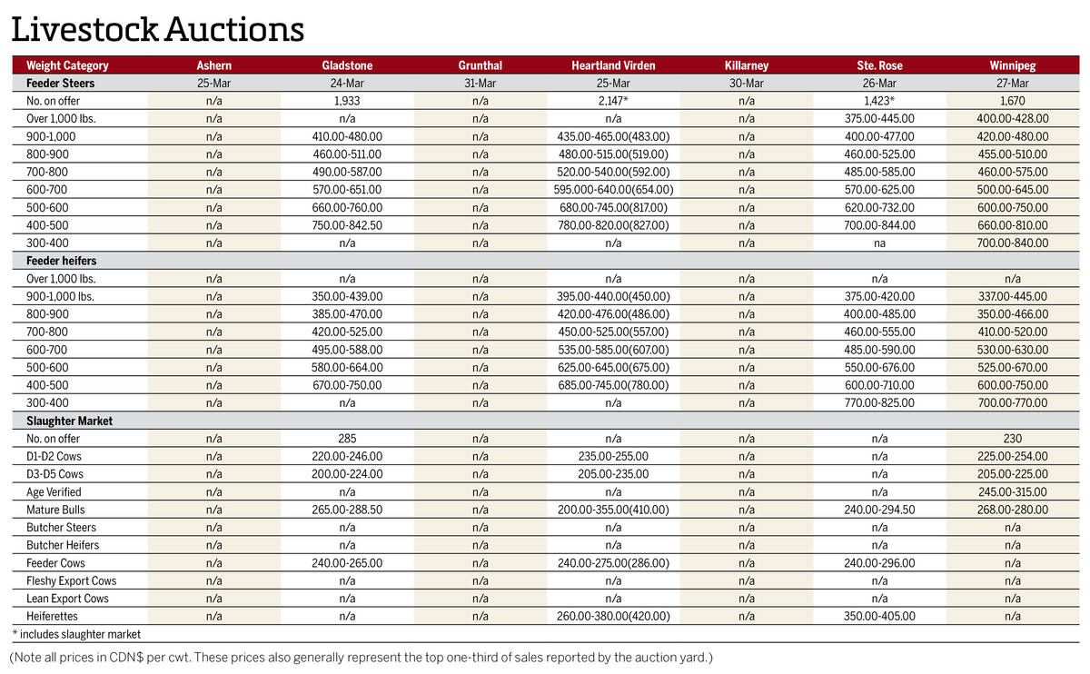
Manitoba cattle prices April 1
Here’s what cattle were selling for in Manitoba from March 24-31, 2026. Four of the seven main livestock auction marts held sales.
A second arctic high is expected to drop southeastward from the Yukon down through Alberta and southern Saskatchewan over the weekend. This will bring a reinforcing shot of cold air and we will once again see daytime highs struggling to make it to -20 C, with overnight lows around -30 C.
Next week looks as if the weather pattern will attempt to shift, but I’m not that confident in this yet. The arctic high will be well to our east and the weather models show a large Pacific high pushing into the U.S. West. This should help moderate our temperatures, but will also help to push the southern storm track farther north. Fortunately, the Pacific high will also keep most of the energy out over the Pacific, so I don’t see any major storms on the horizon, but we’ll likely see more clouds and some flurries. What I’m not sure about is whether the Pacific high will be strong enough to keep any arctic air from trying to slide southward. Only time will tell.
Usual temperature range for this period: Highs, -23 to -6 C; lows, -33 to -14 C.