After a nice hot start to the week, it looks like our old pattern of cool weather will try to re-establish itself over our region next week.
The strong ridge of high pressure that has been giving far western North America hot weather has finally been allowed to drift eastwards. This is what has brought and will continue to bring warm temperatures to our region during most of this week. By Friday, an area of low pressure developing to our southwest will begin to influence our weather with increasing clouds and the chance for thunderstorms. With the increase in clouds we will begin to see temperatures cool.
Read Also
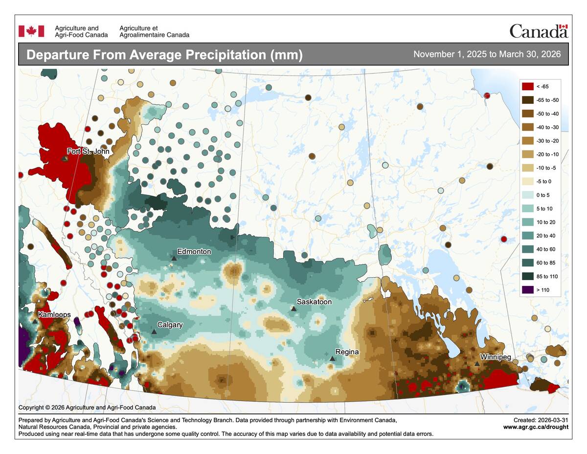
Manitoba winter 2025-26 outstays its welcome
March ran 2 to 3 C below average across central Saskatchewan and southern Manitoba, capping a winter that was drier than normal nearly everywhere but Calgary.
This low will then follow the pattern of most lows this summer; it will push to the northeast and strengthen which will likely keep most regions under cloudy skies along with the chance of some showers. Temperatures will continue to cool down with highs on Sunday only around 20C.
It looks like we will be caught between systems for the first half of next week with high pressure to our west and north and low pressure to our south. How far north the southern low tracks will have a big impact on the weather. Too far north and we will see clouds, showers, and cool temperatures. A little farther south and we should see plenty of sunshine along with near-average temperatures.
Looking beyond this period it does look like summer heat will build back in hopefully bring a nice end to August.
Usual temperature range for this period: Highs: 20 to 29C Lows: 8 to 15C