The weather page is prepared by Daniel Bezte. Dan has a BA Honours degree in geography, specializing in climatology, from the U of W. He has taught climate and weather classes at the U of W, and is a guest climate expert on CJOB’s morning show with Larry Updike. Daniel runs a computerized weather station on his 10 acres near Birds Hill Park, which he plans to develop into a small vegetable and fruit hobby farm.
Daniel welcomes questions and comments at [email protected]
Read Also
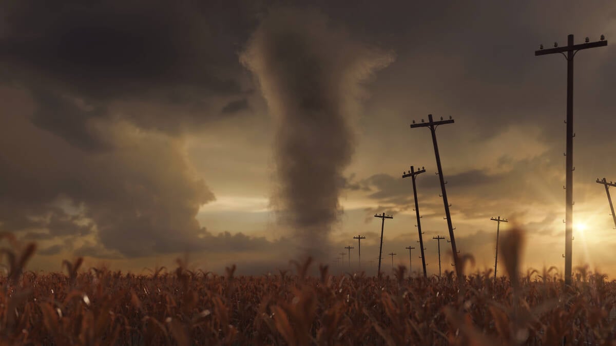
Types of tornado mimics
Not everything with spinning winds on the Canadian Prairies is a tornado. From dust devils to cold-core funnel clouds, there are a number of weather phenomenon that fit the description.
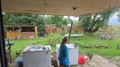
We’ll take a break from clouds this week – we’ve been seeing too much of them lately anyway! Now it’s time for our monthly review of the weather and our look ahead to see what August will have in store for us. One problem I have this week is that I am away camping, so I don’t have access to all of my weather data and records. This means I can’t check to see just how cold we have been.
Yep, I think everyone realizes that we have gone yet another month with below-average temperatures. This makes it eight months in a row – something I would have never predicted. I know I have preached in the past that weather patterns are constantly on the move and that general longterm patterns don’t usually last more than six to eight weeks, but can occasionally last as long as three to four months. So what the heck is going on to give us eight months of below-average temperatures?!
The only way I can explain it is…hmmm…let me see. You know how we have gone through really warm years when just about every month is above average? Or we have gone through drought years when we just can’t seem to get any real rain? Well, I guess this is just like those years, only now we are dealing with cold weather.
In last week’s forecast, I noted that there has been a persistent area of low pressure over eastern North America and a ridge of high pressure over far western North America and that we are stuck in between. Well, this pattern is behaving much like a blocking pattern. It is not a typical Omega block or a Rex block that we have talked about in the past, but kind of a hybrid between the two. We have a really large Omega block-type pattern with high pressure to our far west, low pressure over eastern North America, and the always persistent Bermuda high over the western Atlantic. Then on top of this we have the relationship between the Bermuda High and the eastern North American low. This setup seems to be behaving like a Rex block. Put the two of them together and we just seem to be stuck in the same weather pattern forever.
We will break out of it – eventually, but instead of it being that dramatic turnaround that I thought we would see, it now looks like it will be one of those slow changes that seem to creep up on you unnoticed. I might be wrong, but the weather on my camping trip has been much better than I had predicted and it all started when I became pessimistic about the weather. If the next day’s weather looked bad, I would simply plan for the worst the weather could throw at me and low and behold, it would turn out nice.
Before we take a quick look back at just how bad the numbers for July were, I just can’t help re-enforcing something I wrote about a couple of weeks ago. While we have been seeing cool weather (no all-time record cold temperatures), British Columbia has been having a heat wave. If you haven’t already heard or read about it, several places in B. C. have broken their all-time record high temperatures. In total, eight different locations officially broke all-time records. Vancouver broke theirs twice, while Bella Coola shattered theirs with a reading of 41.2C, a full 3.4C higher than their previous all-time high – and this location has records going back to 1895.
In our neck of the woods, all three of our main regions had below-average temperatures in July. The coolest area was Brandon, but all three areas were very close, with mean temperatures for the month coming in around 16.5C, around 3C below the longterm average.
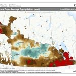
Precipitation-wise, the Dauphin region was the driest area, coming in around 30 to 40 millimetres below their long-term average, with both the Winnipeg and Brandon regions coming in a little on the dry side.
Who was it that predicted this cold, dry month? It seems like only Environment Canada was able to call it right. Will they be able to do it again in August? Well, they are calling for a return to above-average temperatures, especially over western regions, along with near-average rainfall. Over at the Old Farmers Almanac they are calling for more cool weather and below-average rainfall. The Canadian Farmers Almanac appears to be calling for cooler and wetter-than-average conditions. Finally here at the Co-operator, I’m leaning towards EC, with a call of near to slightly above-average temperatures and precipitation. But based on my camping experience, maybe I should say it will be very cold and rainy – let’s hope for the best.