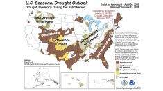
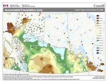
We took a break from our look at clouds to check the monthly look back at weather and look ahead to see what might be in store. Before we get back to the clouds, I want to answer a question about frost; in particular, the difference between radiative and advective frost.
Radiation frost or radiative frost is the typical frost you would experience on a clear, calm night. During this type of frost, the conditions allow heat to escape into the atmosphere, cooling down the very lowest layers. We see little air movement, which can make it easier to protect plants from the frost.
We can also see wide variations in temperatures across short distances as cold air pools in some locations. With radiative frost, temperatures will usually warm up quickly once the sun comes up.
Read Also

Why is the sky blue?
The colour of the skies, on the Prairies and elsewhere, tells the story of the paths sunlight takes as it enters Earth’s atmosphere, Daniel Bezte writes.
Advection frost occurs when a cold or sub-zero air mass moves into a region. It is usually accompanied by winds and lasts much longer than radiation frost. Since all levels of the atmosphere are cold and the wind is mixing up the atmosphere, we do not see variations in temperatures over short distances.
Also, the air is constantly in motion, making it difficult to protect plants. Unlike the radiational frost, the rising sun is not usually accompanied by quickly warming temperatures.
OK, now, as promised, we will examine in more detail our high, middle and low cloud types.
Starting at the top, let’s look at high clouds, known as cirrus clouds. The most common type of cirrus cloud is simply called cirrus. These are high wispy clouds that often look like they have been stretched or blown out into long streamers, what is often referred to as “mares’ tails”.
The reason for this appearance is that cirrus clouds are made up of tiny ice particles that are easily blown about by strong upper-level winds.
Cirrus clouds will generally travel in a west to east direction as they are blown along with the prevailing westerly winds. Generally, they are associated with fair weather, but they can also signal the approach of stormy weather.
Cirrus clouds can be blown off the tops of thunderstorms and stretch out for several hundred kilometres ahead of the storm. Approaching areas of low pressure can also be preceded by cirrus clouds. In both cases, cirrus clouds slowly thicken and are replaced with lower clouds, so when this happens, there is a good chance that wet weather is moving in.
Along with everyday cirrus clouds, we also have cirrostratus clouds. These are high-level clouds that cover the whole sky like a sheet. They are also made up of ice crystals and are usually thin enough that you can see the sun and moon through them. With these clouds we will often see halos around the sun and the moon.
Since they are a thicker form of cirrus, the arrival of cirrostratus clouds usually means a storm system is moving in or is nearby, especially if they are followed by lower cloud types. Cirrocumulus clouds are usually made up of a bunch of smaller looking clouds that group together forming ripples or kind of a scaly appearance. This cloud type is often referred to as a mackerel sky.
Dropping down in the atmosphere, we come to middle level clouds. Here there are two main cloud types: altostratus and altocumulus.
Altocumulus clouds are similar in appearance to cirrocumulus, but will look a little larger and will usually have some gray or shading to them. They occur when the atmosphere is unsettled, but precipitation is rare from these clouds.
Altostratus clouds are gray or sometimes blue-gray and will usually cover the entire sky. With these clouds, the sun or moon can sometimes be dimly seen, but unlike cirrostratus clouds, they will not produce a halo. Another way to determine if the clouds are altostratus or cirrostratus will be their colour. Cirrostratus tends to be white while altostratus will always be gray or blue gray.
Altostratus clouds are often found just ahead of storm systems, so seeing this type of cloud move in will usually be the precursor to some kind of precipitation event.
Finally, let us drop down to low clouds or stratus clouds. Like the alto and cirrostratus clouds, stratus will usually cover the entire sky with a uniform looking cloud. Stratus clouds tend to be a uniform gray colour and are often compared to fog that does not touch the ground.
In fact, when fog rises and is no longer covering the ground, it becomes a layer of stratus cloud. Precipitation rarely falls from stratus, but we can see occasional drizzle. When stratus clouds thicken and become very heavy and wet looking, they are referred to as nimbostratus, which simply means stratus clouds that are producing rain.
These cloud types are associated with continuous precipitation, whether it be rain or snow. They can be hard to see due to falling precipitation but that pretty much tips us off as to the cloud type. As for the type of weather associated with nimbostratus, it’s rainy or snowy.
In our next issue we will continue and possibly wrap up our look at clouds by considering additional terms that we use to describe clouds, rare cloud types and clouds with vertical development.


