Forecast: Chance of major winter storm?

Issued November 20, 2017: Covering the period from November 24 to November 30

It looks like we’ve settled into an early winter pattern that has seen a dominant area of high pressure over western North America and a trough of low pressure over eastern North America. Under this pattern we have seen the main storm track cutting across north-central Canada, placing much of southern and central Manitoba into

La Niña developing in time for winter

Just how powerful the weather phenomenon will be this season is still up in the air

I must begin with a bit of an apology. I had promised that we would be looking at trends in overnight temperatures across the Prairies this week, but we will not be able to cover it this time around. As I was working on the final crunching of the data I realized that I had


Forecast: Back to more typical weather

Issued October30, 2017: Covering the period from November 1 to November 8

It’s looking more and more like winter is moving in early this year. Last year, at this time, we were looking at several weeks of warm record-breaking temperatures; this year, while not record-breaking cold, it looks to be much more like winter. Last week’s forecast played out pretty close to what was expected, with the

A look at snow and super-cooled water

The water in our atmosphere has to be colder than 0 C before it’s cold enough to freeze

As we slowly work our way toward winter and several locations across the Prairies have seen snow, I thought it might be time to revisit the icy topic of snow. Instead of jumping straight into our discussion we’ll look at the process that creates precipitation in cold clouds, which, in our part of the world,


Forecast: Seasonably warm start, then snow?

Issued October 16, 2017: Covering the period from October 18 to October 25

Last week’s forecast played out fairly close to what the weather models predicted. While it did miss out on the Saturday morning snowfall that hit parts of south-central regions, it did catch the weekend cool-down and the warm-up that started this week. For this forecast period, it looks like mild weather will continue to dominate

Forecast: Mild conditions expected to dominate

Issued October 9, 2017: Covering the period from October 11 to October 18

The first half of last week’s forecast played out as expected. Fortunately, the second half didn’t materialize, thanks to a northward shift in the overall pattern. Spring and fall tend to be the toughest times to forecast the weather as the atmosphere begins its transition between summer and winter weather patterns, and we saw this


Another growing season comes to an end

A dry summer generally left workable soils, even after September’s wet second half

Another month has come and gone and it’s time to look back at our weather so far this fall. To start off, we saw the end of the growing season across most regions last week, as temperatures fell just below freezing last Thursday morning. I know at my place the thermometer measured an overnight low

It’s a crucial window to ensure soybean harvest quality as the crop comes off and goes into the bin.

Avoid soybean loss during harvest, drying and storage

Shattered beans can badly affect the profitability of your crop
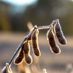
Harvest timing can have a huge impact on soybean shatter losses, according to North Dakota State University Extension Service agricultural engineer Ken Hellevang. “Field losses, splits and cracked seed coats increase as moisture content decreases,” he says. “Shatter losses have been shown to increase significantly when seed moisture falls below 11 per cent or when


Unharvested soybeans on a cold winter morning.

Fall frosts and the frost-free season

The number on your thermometer may not accurately reflect what’s happening on the ground

Every year around this time the weather discussion starts to centre around the first fall frost. Some years, when we see an early-fall frost, the topic is at the forefront of conversations. This year, with only a couple of locations experiencing a fall frost as of Sept. 25, there hasn’t been much discussion. The first

Forecast: Mild and dry weather returns

Issued September 25, 2017: Covering the period from September 27 to October 4

Over the last week or so we saw our first period of unsettled wet weather in a long time. The forecasted system brought some late-season thunderstorms to several regions late last Friday. We then saw another area of light rainfall move through on Sunday. This second system was forecast to stay well to our south,