Forecast: A battle between high and low pressure

Issued September 19, 2016 – Covering the period from September 21 to September 28, 2016

Fall is usually a tough time of year to forecast as we begin our shift from summer to winter. This year looks like it might be tougher than most, since our summer weather pattern was pretty unpredictable. We saw a little of this last week. The storm system that was forecast to track by to

Forecast: Clouds and showers, transitioning to warm and sunny

Issued August 8, 2016 – Covering the period from August 10 to August 17, 2016

As we’ve seen more than once this summer, last week’s upper low ended up being stronger than expected and as a result, it moved slower. The biggest difference in the last couple of upper lows is that instead of bringing clouds and steady rain, they are the focal point for thunderstorms. The rest of last


Forecast: Weather will contain a little bit of everything

Issued July 4, 2016 – Covering the period from July 6 to July 13, 2016

It looks like we’ll be stuck in a rather unsettled weather pattern for at least another week, but there are some hints of some kind of change coming later next week. This forecast period will begin with warm high pressure to our north — that’s right, to our north — and a broad area of

Forecast: Weather outlook a little drier and cooler

Issued June 27, 2016 – Covering the period from June 29 to July 6, 2016

Last week’s weather was almost exactly what was expected. The strong weekend low did track a little farther north than forecast, but it still brought the anticipated stormy wet weather. Luckily, it looks like we’ll see some drier weather during this forecast period — I hope. This forecast period begins with partly cloudy skies on


Cooler air keeps trying to move in

Issued: Monday, Oct. 19, 2015 · Covering: Oct. 21 – Oct. 28, 2015

It’s becoming more and more evident we are moving into the transition phase between fall and winter, as the weather models have a tougher time figuring out the forecast. The first part of last issue’s forecast was pretty good, but the timing of the systems then started to slip. This forecast period will begin with

Main storm track remains to our north

Issued: Monday, Oct. 5, 2015 · Covering: Oct. 7 – Oct. 14, 2015

There were a couple of issues with last week’s forecast. The first was the strength of the area of high pressure that moved through our region and took up position over Ontario late in the week. The second was a weak upper low that kind of got stuck on the western edge of the Ontario


Another week of nice fall weather

Issued: Monday, Sept. 28, 2015 · Covering: Sept. 30 – Oct. 7, 2015

Medium-range weather models have again done a darned good job getting the big picture right. We saw a large low track across the north late last week into this week, bringing strong southerly winds along with very warm temperatures to all of Manitoba Friday and Saturday. As advertised, a cold front pushed through Sunday, bringing

Unsettled start, then sunny and mild

Issued: Monday, September 21, 2015 – Covering: September 23 – September 30, 2015

The mild September weather continued with last week’s forecast coming in pretty darned close to bang-on. For those of you hoping for dry, mild weather to continue, it looks like you’ll be in luck! It looks more and more like the current weather pattern will continue at least into early October, with the main storm


Roller-coaster ride settling into summer weather mode

Issued: Monday, May 25, 2015 – Covering: May 27 – June 3, 2015

You have to love spring across the Prairies. One day it’s cold and snowy and a few days later it feels like summer! It looks like our spring roller-coaster ride is going to continue, but it does appear the ride is coming to an end. After a beautiful weekend and first half of the week,

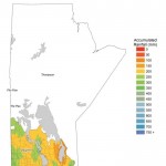
This WeatherFarm map shows the total amount of precipitation across agricultural Manitoba from May 1 through to Aug. 16. The Interlake region has been the driest during this period, with far-western regions seeing fairly wet conditions. The wettest area during this period was in the southern Red River Valley, which received over 500 mm of rain.

Warm and muggy, followed by cool and wet

Issued Monday, August 18, 2014. Covering August 20 – August 27, 2014

It looks like our weather pattern will undergo some changes over the next week or two. This forecast period will start off on the warm side, but by the weekend temperatures could be getting fairly cool. Don’t worry; it doesn’t look like summer is finished just yet. By Wednesday of this week the weather models