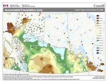
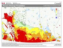
Before we dive into this week’s topic I think I need to change my weather outlook for March. Currently, the medium-range weather models show cooler weather sticking around until at least the third week of March. Even if we see a dramatic warmup during the last week of the month, it will not be enough to boost our temperatures to above-average values. So, it looks like March will be colder than average, and with a major storm hitting most regions on March 6 and 7, chances are it will be a wetter-than-average month as well.
Read Also
Forecasting spring 2026 weather on the Prairies
What weather can farmers expect across Manitoba, Alberta and Saskatchewan as they head into seeding? Plus: a lesson on what makes the seasons turn
Over the last couple of months I’ve been promising two different articles: the top Canadian weather stories of 2016, and the spring flood outlook. With significant precipitation expected across much of Manitoba and southeastern Saskatchewan, I think I will hold off looking at the flood potential until that event plays out. That means it’s time to break down some of the top weather stories of 2016 from across Canada, with particular emphasis on our Prairie region.
The No. 1 weather story of 2016, and one of the top world wide weather stories, was the wildfire that devastated Fort McMurray, Alta. I have already written about this event, so let’s move on to the second-biggest weather story of 2016: the winter that never really was. Thanks in part to a very strong El Niño, most of Canada saw its second-warmest winter on record. What was interesting was how pretty much every part of Canada saw a very warm winter. In the east, Moncton saw its warmest winter in 60 years, while in our region, Winnipeg experienced its first winter where the temperature did not drop below -30 C.
- Read more: Warm weather wins out this winter
The third big weather event of 2016 was the August long weekend thunderstorms that roared across all three Prairie provinces. The storms first fired up across Alberta on July 30 as a strong cold front moved through. Heavy rains flooded parts of Edmonton and Fort McMurray, while hail and strong winds battered a large portion of that province. Over Saskatchewan at least two tornadoes were reported. By Aug. 2 the same cold front moved into Manitoba, bringing a round of severe weather with heavy rains, hail and high winds reported.
Overall it was a very active summer for severe weather, with several severe thunderstorms hitting different parts of southern and central Manitoba. In total, Manitoba experienced 240 severe summer weather events, nearly double the long-term average. Personally, my weather station on July 20 recorded a wind speed of 93.3 km/h, the highest speed I’ve ever recorded since I moved to my current location 15 years ago. The wind was strong enough to push my camping trailer about 30 cm sideways. I think the heavy rains and wet ground kept things from being worse as the trailer was able to slide rather than flip. Luckily I didn’t have too much damage, but several other locations reported many downed trees along with minor structural damage to buildings.
Remember November?
I can’t argue about what is listed as the fourth major weather story of 2016, the record-breaking November heat. In what can only go down as probably the nicest November ever across much of Western and Northern Canada, the month saw mean monthly temperatures as much as 12 C higher than average. According to Environment Canada, at least 20 cities recorded their warmest Novembers on record, including Winnipeg, Brandon, Regina, Prince Albert, Kelowna and Vancouver.
What was truly amazing about this fall heat wave was just how long it lasted (over four weeks) and by how much some of the records were broken. Usually, when either a daily or monthly record is broken it is by a couple of 10ths of a degree. During this warm spell hundreds of daily records were broken, sometimes by as much as 6 C. The monthly records that fell were also broken by large amounts, with several locations beating their records by nearly 2 C.
Our fifth and final story (that is all I have room for) is also heat related and ties into the record-warm winter of 2015-16. After the record-breaking warm winter, April rolled in with cooler-than-average conditions. This led to speculation we were going to pay for the warm winter with a colder-than-average spring. Boy, was that wrong. As we worked our way into May the thermometer began to climb, and climb, and climb. On May 5, temperatures across much of southern Manitoba topped out in the low to mid-30s. Winnipeg was the hot spot, with the daytime high reaching a record-breaking 35.2 C, which was the earliest the city has ever seen temperatures warmer than 35 C. This got everyone talking and worrying about just how hot and dry might the summer be, but luckily temperatures cooled back down and we ended up seeing near-average temperatures over the summer.
In the next issue I hope I’ll be able to review the spring flood potential. It will all depend on the severity of the March 6-7 storm system. If the system is bigger and wetter than expected, it might take some time to figure out what the impact will be. Personally, I hope the system ends up on the weaker side, but as I have pointed out many times in the past, March does tend to have the biggest snowstorms of any time of the year.


