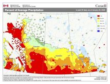
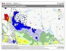
As another month has come and gone, making fall now officially over, and with winter trying to establish a firm grip across the Prairies, it’s time to look back at both November’s weather and the fall of 2021.
We’ll begin our summary of November’s weather across the Prairies with a look at the warmest province in terms of absolute temperatures and compared to average: Alberta. Calgary was the Prairie hot spot in November with a mean monthly temperature of about 1.4 C, a whopping 3.8 C above the long-term average. Further north in the Peace region, it was also very warm compared to average, with Peace River reporting a mean monthly temperature that was 3.3 C above average. In between these two locations, the Edmonton region had a monthly mean temperature of -3.1 C, which was 2.3 C above average. Precipitation across the Peace and Edmonton regions came in right around average, with Calgary reporting amounts that were a little below average.
Moving on to Saskatchewan: Regina was the hot spot, with a mean monthly temperature of -2.3 C, just shy of 3 C above average. Saskatoon was almost as warm, with a reading that came in about 2.4 C above average. Precipitation was uniform, with both locations reporting about 10 mm of water-equivalent precipitation, about four mm below the average for the month of November.
Read Also
VIDEO: What climate change data gets wrong about the Prairies
Precipitation, not temperature, may be a better gauge of climate change impact on the Prairies, says director of the Prairie Adaptation Research Collaborative.
In Manitoba, temperatures were similar to Saskatchewan’s, with all three regions (Winnipeg, Brandon, Dauphin) reporting mean monthly temperatures around 2.5 C above the long-term average. Dauphin was the hot spot with a mean monthly temperature of -2.5 C which was 2.8 C above average. Manitoba was the only province that had a main reporting station that recorded an above-average amount of precipitation. Winnipeg saw 35.3 mm, which was about 10 mm above average. Precipitation in Brandon was just slightly below average with 15 mm, while Dauphin’s nine mm came in about 12 mm below average.
Overall, it was a warm November with near to slightly below average precipitation. Looking at the fall of 2021 (September through to the end of November), it was very much like November itself, warm with below-average precipitation. Manitoba was the warmest, with Winnipeg claiming the title for fall hot spot, with a mean fall temperature of 7.3 C, a solid 3 C above average. The title for biggest difference from average was also in Manitoba, where Dauphin’s mean fall temperature of 6.8 C was 3.2 C above average. Temperatures, compared to average, cooled a little bit as you moved westward from Manitoba. In Saskatchewan, Regina reported a mean fall temperature that was 2.5 C above average, with Saskatoon coming in at 2.1 C above average. In Alberta, Calgary was the warm spot, with an average fall temperature of 6.7 C, which was 2.1 C above average. Both Edmonton and Peace River saw mean fall temperatures right around 1.8 C above average. Fall precipitation was below average across all the major sites, ranging from 16 mm below average in Winnipeg to nearly 45 mm below average in Saskatoon. All in all, it was a very warm — and, in some places, very dry — fall across the Prairies this year.
The big question now is whether we are going to see a cold winter across the Prairies or are we going to end up seeing a repeat of last year’s winter? Winter is only a couple of weeks old and while the medium-range forecasts are not looking too promising for major snowfall, let’s take a look at some of the longer-range forecasts to see if there is any hope for significant precipitation in sight.
Starting off with the two almanacs: the Old Farmer’s Almanac forecast looks promising as it calls for near-average temperatures in both December and January along with above-average precipitation. This is then followed up by well above-average temperatures in February along with near-average precipitation. Over at the Canadian Farmers’ Almanac, the winter forecast appears to call for near-average temperatures and precipitation in December followed by near-average temperatures and above-average snowfall in January. Its February outlook is for below-average temperatures with near to average precipitation, based on how often it mentions cold or very cold.
Moving on to the various weather models: NOAA looks to be calling for near-average temperatures over the eastern Prairies, with below-average temperatures in the west. Its precipitation forecast calls for near-average amounts over eastern regions with Alberta seeing the best chance of above-average precipitation. The CFS model predicts that after a warm start to December, temperatures will cool to below average later in the month, with below-average temperatures continuing into January and February. Precipitation is predicted to be near average with western parts of Alberta possibly seeing above-average amounts. The CanSIPS weather model is calling for colder-than-average temperatures right across the Prairies in December, with the eastern Prairies slowly warming to near or a little above average by February. Precipitation is forecast to be above average in December, falling to near average in both January and February.
Last and most certainly least, my winter outlook. As much as I want to see a lot of snow, my gut is getting worried that the drought conditions will continue. While we will continue to see periods of mild weather, there will be outbreaks of cold weather, resulting in overall temperatures coming in near average. How’s that for hedging my bets?


