I now have all of September’s weather data from the main reporting stations across the Prairies and we can finally get to our monthly weather review. I thought I would be able to include material on how the summer measured up but that will have to wait.
However, we will do the usual look ahead to see latest three-month forecasts and predictions. After all, winter is just around the corner.
The last time I did a monthly review, I changed things up a bit. Instead of going province by province, I ranked the main reporting sites by mean temperature, how far above or below average that temperature was, total precipitation and how much above or below average that precipitation was. I presented the data in a series of tables, followed by a short discussion.
Read Also

Prairie weather all starts with the sun
The sun’s radiation comes to us in many forms, some of which are harmful to organic life while others are completely harmless or even essential, Daniel Bezte writes.
I got positive feedback, so we’ll do it again for September.
Temperature
Let’s start with temperatures and the ranking of mean monthly temperatures across the Prairies. While I knew it was a warm month, some of these values surprised me.
| Location | Mean temperature (°C) | Difference from average (°C) |
| Winnipeg | 17.8 | 5.1 |
| Dauphin | 17.3 | 5.6 |
| Brandon | 16.6 | 4.8 |
| Regina | 16.4 | 4.6 |
| Saskatoon | 15.8 | 4.4 |
| Calgary | 14.2 | 3.2 |
| Edmonton | 13.1 | 2.9 |
| Peace River | 11.9 | 2.3 |
The data shows that the warmest region and the region with the highest above-average temperatures were in the eastern Prairies. I must admit, I wish I was retired. This September was amazing in Manitoba. I was on the beach Sept. 28.
These temperatures were all warmer than what we experienced in June. Monthly temperatures that are two to three degrees above average are a little unusual, and temperatures three to more than five degrees above average are very unusual. It has been over 20 years since we had a September this much above average.
Rain
Here are the precipitation values for September.
| Location |
Precipitation (mm) |
Difference from average (mm) |
|
Winnipeg |
43 |
-9.3 |
|
Dauphin |
29.6 |
-28.6 |
|
Brandon |
33 |
-10.7 |
|
Regina |
54.8 |
22 |
|
Saskatoon |
35.3 |
-0.1 |
|
Calgary |
63.7 |
18.6 |
|
Edmonton |
24.5 |
-16.8 |
|
Peace River |
22.7 |
-16.5 |
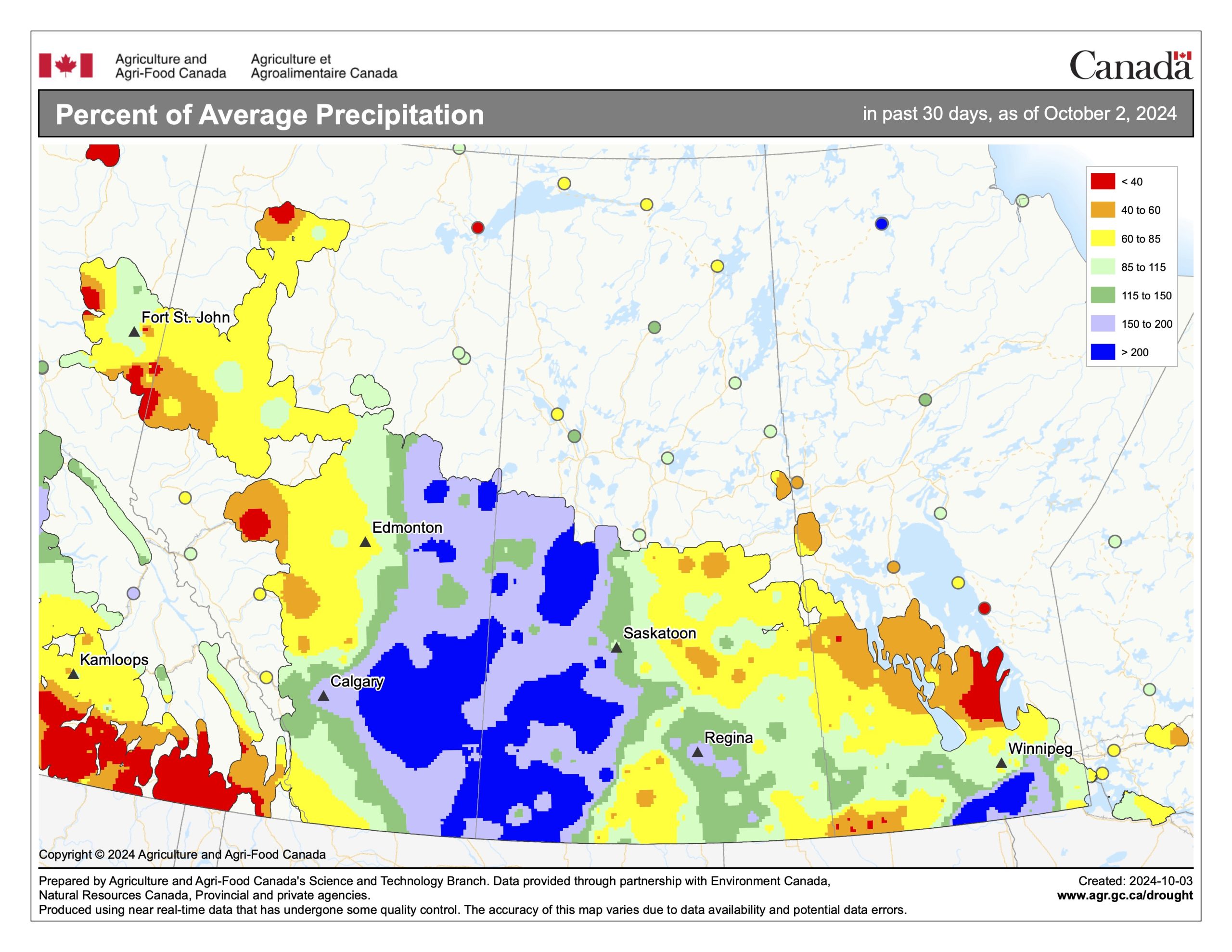
There is no clear trend across the Prairies because most of the rain in September came from thunderstorms. We all know how hit and miss they can be.
In fact, using only these stations to represent the September rainfall across the Prairies misses the heavy rainfall events that affected much of eastern Alberta and western Saskatchewan, along with extreme south-central Manitoba.
To sum up: It was a much warmer than average September across the Prairies, with precipitation ranging from below average to well above average, but overall precipitation was near average. Looking at the different predictions for the month, it looks to be a tie between the Old Farmers Almanac and the Canadian CanSIPS model. Both called for well above-average temperatures with near- to below-average precipitation.
Outlook
Our three-month outlook will encompass part of winter. After what could be considered a non-winter last year, the big question is whether we will pay the price this winter.
The Old Farmers Almanac calls for a warmer and slightly drier than average October, followed by a much warmer and slightly wetter than average November. The warmer conditions are forecasted to continue into December, with above-average precipitation.
The Canadian Farmers Almanac calls for near- to slightly below-average temperatures in October with near-average precipitation, followed by a very turbulent November with wild temperature swings and plenty of snow. Its December forecast is for more snow and near-average temperatures.
As for NOAA’s three-month outlook, extrapolating northward, it looks like the agency is calling for near-average temperatures and precipitation over the next three months. The exception is over southern and western Alberta, which is forecasted to have an above-average chance of above-average precipitation.
Next on the list is the usually reliable CFS model. It is calling for well-above-average temperatures in October, with near- to below-average precipitation. Above-average temperatures are expected to continue into November and December, but December temperatures will slowly return to average values. Precipitation during this period is forecasted to be near average.
The CanSIPS model is forecasting a warmer than average October with below-average precipitation. The model then shows a switch to near- to slightly below-average temperatures in November and December, along with near-average precipitation.
The ECMWF model is forecasting above-average temperatures in October and November, with near- to slightly above-average temperatures in December. Its precipitation forecast is calling for near-average amounts in October and above-average amounts for November and December, especially over the western half of the Prairies.
As for my two cents, we are heading into what looks to be a weak La Niña winter. I will provide a more in-depth look at what this historically means but, for this forecast, I will go with the average La Niña winter. This means near- to slightly below-average temperatures, along with near to maybe slightly above-average precipitation. We’ll talk more about this over the next month.
Coming up is our summer weather review, followed by our look at frost and then snow fences. With drought and water always at top of mind, capturing snow can be important.


