While this summer’s weather hasn’t been the easiest to figure out, the weather models have been doing a pretty good job of getting the big picture right. This was the case once again for last week’s forecast as the upper low stalled out over Hudson Bay as expected, and brought cooler air and afternoon clouds to at least eastern regions over the weekend.
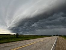
This forecast looks to continue with the slightly cooler-than-average temperatures, as the general upper-level flow remains out of the northwest. Weak high pressure will be in place to start this forecast period, bringing plenty of sunshine along with daytime highs in the low 20s. As this high slides off to the east we’ll see a bit of a rebound in the upper-level ridge on Thursday and Friday that should allow warmer air to move in. An area of low pressure is also forecast to overtop this ridge, bringing increasing clouds along with some showers and thundershowers. The best chances for measurable rain look to be late Friday and into Saturday morning.
Read Also

June brings drought relief to western Prairies
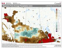
Farmers on the Canadian Prairies saw more rain in June than they did earlier in the 2025 growing season
Surface high pressure will build in later in the day on Saturday, bringing clearing skies. These clear skies should stick around on Sunday and Monday, with daytime highs expected to be in the mid- to upper 20s. A trough of low pressure is expected to develop to our west on Monday, which should result in increasing southerly winds along with a return to more humid values. This trough is then forecast to push through on Tuesday, bringing the chance of more thunderstorms.
Looking further ahead, there are some signs of the western upper ridge building and pushing eastward, bringing a return to above-average temperatures late next week.
Usual temperature range for this period: Highs, 20 to 30 C; lows, 8 to 15 C.


