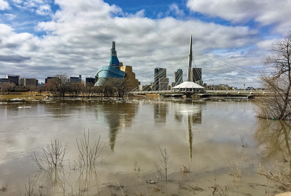
Cooler temperatures toward the end of March slowed spring melt, but risk of major flooding remains high along the Red River, according to a report from the United States National Weather Service.
A March 19 report said cool temperatures over the following week would continue the gradual thaw, allowing snowmelt to slowly reach streams and rivers.
In Manitoba, the province said little has changed since the flood outlook report released on February 27.
“The province is monitoring the situation and as always has contingency plans in place,” said a provincial spokesperson in an emailed statement.
Read Also

PHOTOS: Farming in focus at Royal Manitoba Winter Fair
The 2026 Royal Manitoba Winter Fair once again brought farm education, thrilling horse sports and livestock events to Brandon.
The report said the Red River was at a higher risk of major flooding due to high soil moisture at freeze-up in southern and central Manitoba. Above-normal snowfall in the U.S. portion of the Red River Basin toward the end of February also increased flooding risks.
A March 16 report from the National Weather Service put major flooding risks between Fargo and Pembina at “greater than 65 per cent.”
The report said the risk of major spring flooding along the Assiniboine, Souris, Qu’Appelle and Saskatchewan rivers is low.
Risk of major flooding is also low in the Interlake, which saw drought for most of 2019, and northern Manitoba.
To questions about how the COVID-19 pandemic might affect flood-fighting efforts, the province said, “Should those measures be required, Manitoba Families and MHSAL (Manitoba Health, Seniors and Active Living) would work with Emergency Management planners to adapt health guidelines.”
The next provincial flood outlook report will come out at the end of March, the spokesperson said.