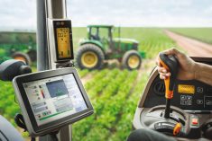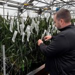
Farmers have access to an expanding range of eyes in the sky to monitor their crops, but high-tech aids are not a replacement for boots on the ground, says Matt Fagnou, manager of Precision Ag/Echelon Canada.
“Imagery can guide to where to scout and sample but there’s still no replacement for us being in the field,” Fagnou said during a presentation at the recent Ag in Motion Discovery Plus virtual farm show.
For example, an image captured by satellite, fixed wing aircraft or drone might identify a section of the field affected by disease, but that information may come in too late to do anything about it.
Read Also

Manitoba’s 2026 budget boosts loan limits, insurance and farm support programs
Manitoba’s 2026 budget expands farm support programs with higher loan limits, new insurance incentives and $143.7M in agricultural funding.
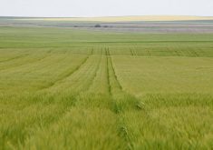
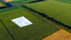
A single image of a field can be quite useful. It can allow a producer to see what sections of a field that they need to test to diagnose why some areas are doing better than others. However, it only identifies differences from one area of the field to another at that single moment in time.
That said, Fagnou said the technologies now available are proving helpful in supporting day-to-day decisions on the farm.
Fagnou outlined the strengths and weaknesses of the three main types of imagery available today: satellite imagery, fixed wing aircraft imagery and drones.
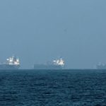
Satellite imagery is the most commonly seen form of imagery in agriculture today and is desirable for a number of reasons. Satellites have the ability to cover extremely large areas quickly; they are operational 365 days a year and the information being collected is consistent.
“The nice thing about that is we have all the historical images from when the satellite started taking pictures. We didn’t have to task it to do that, it’s already being done,” said Fagnou. However, satellites are very expensive to launch, they have a fixed flight plan, they are unable to see through clouds, and they are very difficult to repair if a sensor breaks.
Fixed wing aircraft allow a little more flexibility. They can still cover large areas in a single flight and they record at a higher resolution. They can fly the same field multiple times. The multiple sensors they can carry can easily be changed out as technology progresses and they can fly underneath the clouds. The biggest downside to fixed wing aircraft is the need for a trained pilot to fly it. They are also limited by the need to be within proximity of an airport.
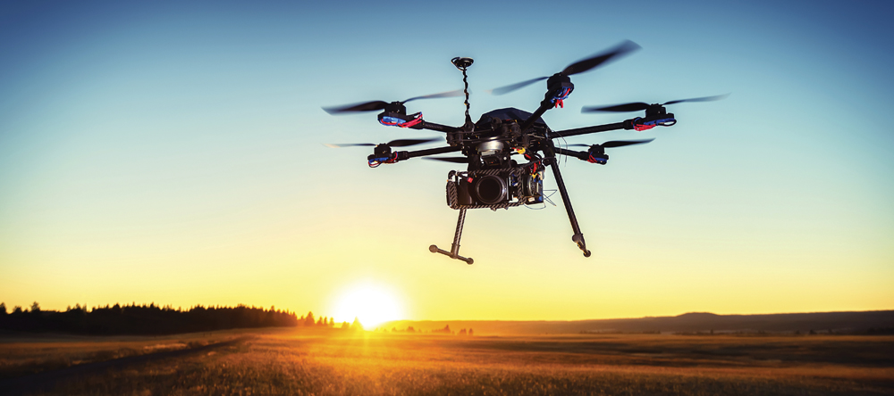
The newest kid on the block, and the one everyone seems most excited about, are drones. They are easy to deploy and almost anyone can operate one, although training and certification are needed. They also have the ability to take extremely high resolution images. However, they have limited ability to fly in adverse weather conditions and they are not commercially scalable.
“They work for on-farm work, but when we’re trying to cover thousands of acres a day, they just don’t lend themselves well,” said Fagnou.
Regardless of the imaging source, the sensors all use what is known as NDVI (Normalized Difference Vegetation Index). An NDVI sensor looks at how much green light is reflected back. The result produces an image that varies from green (representing high biomass – so productive) to red (next to no biomass – non-productive).
“When we look at these, there’s something common to remember,” says Fagnou. “All images are historical. The plants are showing the effect of what happened to them.”
A single image of a field can be quite useful. It can allow a producer to see what sections of a field that they need to test to diagnose why some areas are doing better than others. However, it only identifies differences from one area of the field to another at that single moment in time.
A much more practical way to utilize the image is to compare the current image to several images of the same field taken over a multi-year period. A single image might indicate that a certain section of land is underproductive, when in reality it is only underproducing at that moment.
For example, it could be showing up that way because of a recent weather event that left a low-lying area inundated with water. Whereas a multi-year stack could show that the area is normally quite productive.
Having that information narrows down the problem for the producer. “Multi-year, weather weighted imagery gives us the best average of productivity — the best average of where plants actually grow, compared to yield in any given year,” Fagnou said.