A short forecast this week as spring tries to regain control across the Prairies.
There’s currently a large area of low pressure over northwestern Ontario that will slowly spin down and drift off to the northeast. To the west, an area of low pressure off the southern B.C. coast is forecasted to drop southwards over the next several days before tracking inland over central California. This will place the Prairies in a westerly to slightly northwesterly flow to start off the forecast period.
The main weather maker will be a trough of low pressure forecasted to develop over the northwestern U.S. today, which will then track eastwards over the next several days.
Read Also
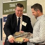
BASF announces $27M Saskatoon canola breeding facility expansion
BASF is investing $27 million to expand its Canola Breeding Centre of Innovation in Saskatoon with the hopes of refining and accelerating the development of hybrid canola.
This low will bring clouds and the chance of snow to southern and central Alberta on Thursday, Saskatchewan on Friday, and Manitoba on Saturday. Amounts don’t look heavy with most areas seeing less than three centimetres. Temperatures ahead of this trough will be mild but colder air will move in behind the trough keeping daytime highs near to slightly below zero.
Warmer air will start to push in by Sunday over Alberta. Saskatchewan and Manitoba will see the milder air by Monday. Expect daytime highs to be in the low teens across Alberta and in the 6 to 10 degree range in Saskatchewan and Manitoba.
I would like to say that this be the end of winter weather, but the models are hinting at some more stormy winter weather late next week, especially over the eastern half of the Prairies. As usual, that’s a long way off and a lot can change between now and then.
— Daniel Bezte is a teacher by profession with a B.A. (Hon.) in geography, specializing in climatology from the University of Winnipeg. He operates a computerized weather station near Birds Hill Park, Man. Contact him via email with your questions and comments.