Forecast issued Dec. 24, covering Dec. 24 to 31, 2025
Highlights
- After snow on Wednesday, Alberta should have a reprieve for Christmas before another system moves in late Boxing Day.
- Snow will track across Saskatchewan and Manitoba on Christmas Day, but most of it will stay north of the Trans Canada highway.
- Saskatchewan and Manitoba will see icy temperatures to start next week, but the cold snap looks to be short-lived.
Overview
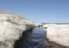
The pattern of Pacific storm system after Pacific storm system looks set to continue for a while longer. We begin this forecast period with a heavy snowfall warning in effect across parts of Alberta.
Read Also
Get farmers in on federal water security strategy planning, CFA says
Farmers should be involved in the development of a Canadian fresh water security strategy, the Canadian Federation of Agriculture says.
A large area of low pressure off the west coast of the United States is slowly pushing inland. In the process, it is sending piece after piece of energy eastward, which are spawning smaller areas of low pressure. These then track through the Prairies.
For this forecast period, the first of these lows is already impacting Alberta and bringing cloud and widespread snowfall. Amounts are expected to range from around 5 cm over southern regions to upwards of 15 cm over central areas.
More weather coverage: Prairie winter snowfall forecast 2025-2026
This low is then forecast to track across the south-central Prairies on Thursday and Friday, bringing periods of snow. Snowfall totals are expected to range from just a few centimeters near the border to upwards of 10 cm over central regions.
Over the weekend, a second area of low pressure is forecast to develop over southern Alberta and will quickly track eastward, bringing what looks to be another quick shot of snow. This system is expected to track a little farther south with the southern portions of all three Prairie provinces seeing mostly cloudy skies and some snow. At this point, snowfall totals look to fall within the 5 to 10 cm range.
Colder air will briefly build in behind this low, but yet another storm system—this time pushing in from the Gulf of Alaska—will help pull warmer air northward for the final couple of days of 2025. This system is expected to move into northern Alberta on Tuesday and track southeastward into southern Manitoba by New Year’s Eve.
Snowfall amounts from this system look to be light.
Alberta
Pacific energy pushing northeastward from a large area of low pressure off the Oregon coast is forecast to bring widespread snowfall to much of Alberta today. Snow is expected to blossom across the province from south to north, with total amounts ranging from around 5 cm over southern regions to upwards of 15 cm over central areas.
The system should exit the province by Thursday morning, allowing for some brief clearing before the next system begins pushing in on Friday.
Additional energy from the Pacific low will help develop another area of low pressure over southern Alberta on late Friday. This low will track farther south than the previous system, bringing snow to the southern half of the province from Friday night into Saturday.
Current indications suggest around 5 cm of snow with this system, though some areas could see upwards of 10 cm. As with the previous low, colder high pressure will build in behind it, bringing a return to sunny skies and colder temperatures on Sunday.
Yet another area of low pressure looks set to impact Alberta early next week, but this system will push into northern Alberta thanks to a large area of low pressure over the Gulf of Alaska.
This low will do two things: it will help pull warmer air northward, pushing daytime highs above the freezing mark, and it will bring snowfall to far northern regions on Monday and Tuesday. This low will then drop southeastward and should be out of the province by New Year’s Eve.
Saskatchewan and Manitoba
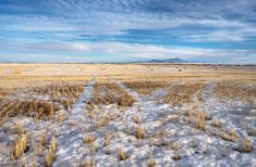
This forecast period looks to start with cloudy to occasionally partly cloudy skies, along with the chance of a few flurries. A more organized area of snow is expected to develop over Alberta on Wednesday and then track eastward across the central Prairies on Thursday.
Most of the snow from this system appears likely to stay north of the Trans-Canada Highway, with central regions seeing a quick 5 cm or so before the system slides east by Boxing Day.
More weather coverage: When was the best holiday weather?
Cool high pressure will build in on Boxing Day and into the early weekend. This will bring a mix of sun and cloud and near-average temperatures. Weather models then show another area of low pressure developing over southern Alberta on Saturday, which is forecast to quickly zip through the southern Prairies on Sunday. This should bring another quick shot of snow. The fast-moving nature of this system should limit totals, with most areas seeing between 2 and 5 cm.
Cold Arctic high pressure is forecast to build in behind this low. This should bring sunny to partly-cloudy skies and near to slightly below-average temperatures to start next week.
This break from clouds and light snow looks short-lived, as yet another area of low pressure is expected to move through late Tuesday into Wednesday. This low will drop south from northern Alberta, keeping most of the snow over central and northern Saskatchewan late Tuesday and over central Manitoba on Wednesday.
Unsettled conditions look to continue into the New Year as a second, weaker low quickly follows the initial system.