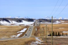
It is looking more and more like the weather pattern we’ve seen for most of April will soon break down, switching to what looks to be a much more summery pattern. Unfortunately, some regions will have to wait another week.
We start this forecast period with an area of low pressure exiting the eastern Prairie and taking the rain and wet snow with it. To the west, a weak frontal system looks ready to drop into northern Alberta where it should bring scattered showers.
High pressure then looks to build across the Prairies, which should bring plenty of sunshine and mild temperatures. These conditions look to stick around until next week. Then the weather models are showing are large area of low pressure developing over the American mid-west and lifting north. This should bring a good shot of rain to southern Manitoba and Saskatchewan on Monday. Often with these systems, an inverted trough will develop to the northwest of the system. Should this happen, parts of southern Alberta could also see some rain.
Read Also

Farmers’ Almanac rescued from closure; fate of Canadian content unknown
The Farmers’ Almanac, which had said last fall it would cease publication at the end of 2025, will now continue under new ownership.
This system should push out of the eastern Prairies by the middle of next week. The weather models then show broad and sustained upper-level ridging building across the Prairies. Should this materialize, expect sunny and dry weather across the Prairies with daytime highs in the low to mid-twenties by late in the week.
Alberta
A weak cold front will push into north-central Alberta on Wednesday and bring a mix of sun and clouds and the chance of the odd shower. Temperatures north of the front will be on the cool side with daytime highs in the 8 to 12 C range. Over the southern half of the province, skies will be sunny to partly cloudy with daytime highs in the 14 to 16 C range.
On Thursday, an upper ridge will begin to build across the province. This will bring sunny to partly cloudy skies and warm temperatures. Daytime highs by Friday are forecasted to be in the upper teens to low twenties with overnight lows falling to around 5 C. These mild temperatures look to last through the weekend.
Early next week, a developing area of low pressure over the American Midwest will bring increasing clouds over southern regions and the chance of showers. As the low lifts northeastwards into the eastern Prairies, the counterclockwise rotation around the low will pull cooler air southwards into Alberta. Expect daytime highs across most regions to drop into the low teens. These cooler temperatures shouldn’t stick around for long as the weather models are showing strong upper-level ridging building back in during the second half of the week. This should push temperatures back into the low twenties for highs.
Saskatchewan and Manitoba
On Wednesday, Southern Manitoba and southeastern Saskatchewan will be dealing with the remnants of the area of low pressure that brought rain to southern Manitoba and wet snow to southeastern Saskatchewan on Tuesday. Expect cloudy skies across these regions with a few lingering showers or flurries.
Under the clouds and cool northerly flow, expect daytime highs to only be in the 5 to 8 C range. Further north and west in Saskatchewan, skies should be partly cloudy to mostly sunny with daytime highs in the 10 to 14 C range.
On Thursday and into the weekend, a building upper-level ridge will bring mostly sunny skies and mild temperatures. Daytime highs over Saskatchewan will hit the mid teens on Thursday and upper teens or low twenties by Friday. Manitoba will see milder temperatures pushing in on Thursday with daytime highs forecasted to be in the mid to upper teens.
Over the weekend, a develop area of low pressure over the American Midwest will begin to impact southern Saskatchewan and Manitoba. As usual, confidence in the timing and placement of this system this far out is low. The latest model run is showing increasing clouds on Sunday with rain forecasted to move in overnight Sunday and early Monday.
There is the potential for this system to bring upwards of 20 mm of rain. Southern Manitoba sees the best chances of significant rain. The rain should pull out of these regions by Tuesday as cooler air pushes southwards behind the low. Expect daytime highs on Monday to be around 14 C, cooling to around 10 C by Tuesday.
It doesn’t look like the cool air will stick around for long. The weather models show upper-level ridging rebuilding across the Prairies during the second half of the week. This should allow temperatures to warm into the upper teens or low twenties by late in the week.


