It looks like we will be under the influence of high pressure and a predominately northwest flow for the majority of this forecast period.
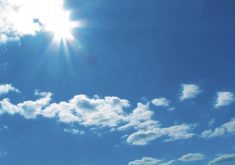
This will result in more sunshine than cloud over the next five to seven days, along with temperatures continuing to be in the middle of the usual temperature range for this time of year.
There will be some weak areas of low pressure sliding by well to our south during this forecast period, but at most all we will see are a few clouds from these systems. With the rapidly increasing sun angle any days with full sunshine and light winds will feel pretty darned nice.
Read Also
Why is the sky blue?
The colour of the skies, on the Prairies and elsewhere, tells the story of the paths sunlight takes as it enters Earth’s atmosphere, Daniel Bezte writes.
Unfortunately, everything isn’t coming up roses in the forecast. The longer-range forecasts are showing an area of low pressure dropping southeastwards from northern Canada early next week. This low could bring some stormy conditions to start the week, especially to northern and central areas of Manitoba.
Following this low the models are pointing towards an outbreak of arctic air, as a strong Arctic high builds in behind the low. Currently the models are keeping the coldest air to our northeast but we will have to watch this as a slight shift southwards could result in temperatures bottoming out in the -30C range.
So, it doesn’t look like spring is just around the corner and it appears that winter isn’t coming to an end anytime soon.
Usual temperature range for this period: Highs: -16 to -2C Lows: -29 to -10C


