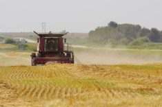
When it comes to heavy rainfall, I haven’t written much about it in 20 years of weather reporting. Let’s splash in with our continued look at this phenomenon.
Several factors must come together for an extreme rainfall event to occur. Sometimes you need more than one factor and other times, if the factor is strong enough, you just need one. Let’s look at those factors.
Atmospheric moisture: For heavy rain, there must be a significant supply of moisture in the atmosphere. When warm, moist air masses interact with cooler air, it can lead to condensation of water vapour and formation of clouds and precipitation. Across the Prairies, we experience the influx of moisture-laden air from different directions, such as from the Gulf of Mexico or the Pacific Ocean, which can contribute to the potential for heavy rain.
Read Also

Forecasting spring 2026 weather on the Prairies
What weather can farmers expect across Manitoba, Alberta and Saskatchewan as they head into seeding? Plus: a lesson on what makes the seasons turn
For really extreme rainfall events, we need the atmospheric moisture to be deep; that is, a large portion of the atmosphere must be moist.
This deep moisture is referred to as precipitable water, and is measured by stating the amount of rainfall that would occur if all the moisture over a region fell as rain all at once. When there is a lot of deep moisture across our region, we can typically see this value in the 50 millimetre range, but that doesn’t mean this is the greatest amount of rain we can see.
Atmospheric instability: This refers to the condition in which warm, moist air at the surface is overlaid by cooler, drier air aloft. This creates an environment conducive to development of thunderstorms and heavy rainfall.
As the sun warms the surface, it heats the surrounding air, and that air begins to rise. This rising air will cool, but if it cools at a slower rate than that of the atmosphere around it, then the air will continue to rise, eventually cooling to the point that condensation will occur.
Remember total precipitable water? Well, as that air rises, new air moves in horizontally that is also full of moisture. That air will eventually rise, bringing even more moisture into the upper atmosphere to condense. This is why you can get rainfall that exceeds the precipitable water value.
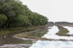
Orographic lift and topography: This factor is confined to certain parts of the Prairies such as the Manitoba escarpment and the Rocky Mountains. While the Prairies are generally flat, there are variations in terrain that influence the behaviour of storm systems.
Even subtle changes in elevation, such as low hills or ridges, can play a role in enhancing rainfall. When moist air is forced to rise over elevated features, a process known as orographic lift occurs. As the air is lifted, it cools and condenses, leading to cloud formation and precipitation. This effect can enhance rainfall over certain areas of the Prairies that are situated in the path of prevailing winds.
We can see this in Manitoba around the Dauphin/Riding Mountain region, but it is especially evident in Alberta when easterly winds push up against the mountains. This is one of the leading reasons behind epic flooding that hit southwestern Alberta in 2013.
Storm dynamics: This is basically how a storm system behaves. Rainfall events come from different types of storm systems, such as fronts, areas of low pressure and convective thunderstorms. Each of these systems can produce heavy or extreme rainfall, depending on their dynamics.
The behaviour that contributes the most to extreme rainfall events is the speed at which they move. The slower the system, the greater chance of heavy rain. When a front or an area of low-pressure moves slowly, or even stops moving, the mechanism in place for producing rainfall stays over one region.
Most rain producing systems have the potential to bring heavy rain, but they just don’t stay over one place long enough. Even convective thunderstorms can stall out, but that usually does not create conditions that create heavy rain, because a stalled storm will usually self-destruct in a short time.
What is dangerous with convective thunderstorms is when “training” occurs. Training is when a series of thunderstorms form and move over the same region. One stowrm will develop and bring heavy rain. As it starts to move off and self-destruct, a second storm quickly develops and replaces thefirst storm, and so on.
From the ground, it will often seem like one big storm that keeps on going. Heavy rain develops, there is a short lull and then it picks up again. Training thunderstorms have resulted in some of the heaviest amounts of rain across the Prairies.
Convergence zones: These are similar to topography and orographic lift. They are areas where winds from different directions converge, forcing air to rise. They can form nearly anywhere when winds of opposing directions meet. These zones can act as focal points for storm development and can lead to formation of heavy rain-producing thunderstorms.