Over the last week or so, the general weather pattern across much of central and northern North America has undergone a major shift. The polar vortex has broken down as expected, the western ridge of high pressure has weakened and moved farther off the coast, and the long-wave trough of low pressure over eastern regions has been partially replaced by a ridge of high pressure. While this has created extreme changes in weather over western and eastern regions of North America, for our region the changes have been a little more subtle.
Read Also

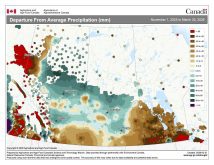
VIDEO: Here’s Manitoba’s 2026 spring storm forecast
Weather models are calling for above-average precipitation in southern Manitoba, with at least two more Alberta clippers possible.
This forecast period begins with our region sandwiched between three areas of high pressure: one to our southeast, another to our north, and the third off the West Coast of B.C. This will result in fairly quiet weather with partly to mostly sunny skies, along with temperatures running close to the high end of the usual temperature range for this time of the year.
Things get complicated over the weekend as the West Coast low moves inland. The weather models are really struggling with this system. Current model runs show the low slowly meandering across our region, bringing clouds and the chance of light snow every day from Saturday to Monday. Currently, it doesn’t look like we’ll see significant snowfall from this system, but some regions could see up to 10 cm. Temperatures look to remain on the mild side, but with plenty of cloud cover daytime highs should remain several degrees below freezing.
For next week, a weak arctic high pressure system is forecast to drop southward, bringing sunny skies and slightly cooler temperatures. It doesn’t look like we will see a return to the bitterly cold temperatures we have seen this winter, but temperatures will return to more seasonable values. Expect daytime highs to be in the -10 C range with overnight lows in the -18 C range.
Usual temperature range for this period: Highs, -13 to -1 C; lows, -26 to -10 C.