In a previous article we began our look back at how 2022 shaped up, weather-wise, by examining global temperature patterns. This time we will zoom in closer to home and begin our annual review of Environment Canada’s top weather stories of 2022. As usual, I will put a bit of my own spin on some of these stories and will change the order of stories to take on a bit more of a Prairie focus.
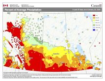
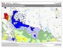
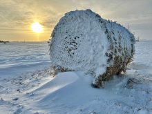
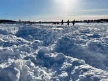
If you lived in southern Manitoba during 2022, then I think you would agree the biggest weather story of 2022 was the parade of early spring storms that brought record amounts of precipitation and led to some of the longest and worst flooding on record. After a snowy winter, in which large areas of southern Manitoba saw upwards of 150 cm of snow, the big questions leading into the spring melt were just how long was it going to take to melt all that snow and how bad was the flooding going to be? March was a relatively quiet month with a cold start and then a slow melt developed by the middle of the month. These conditions continued into the first half of April, with the general snowpack melting away by about the 10th of the month. It seemed as if we dodged a weather and flooding bullet. Then it all went bad as a series of Colorado lows began what turned out to be a prolonged 45-day precipitation assault on our region.
The first storm moved in around April 13-14, dumping heavy snow in most areas with some rain mixing in over eastern regions. This system was followed up by a second storm on April 22-23 that dumped upward of 50 mm of rain with a little snow thrown in for good measure. To make matters even worse, a third storm during the last two days of April brought another 40 to 50 mm of rain to eastern regions, including the Red River valley, though western regions missed out on this storm.
Read Also
Canada’s import ban on Avix bird control system ruffles feathers
Canadian producers’ access to Bird Control Group’s Avix laser system remains blocked despite efficacy studies and certifications, as avian flu deaths rise.
These three storms alone brought anywhere from double to quadruple the usual amount of April precipitation and rapidly increased the flood threat — but Mother Nature and her Colorado low parade were not done. As we moved into May, hoping for warm dry weather, a fourth storm system moved in around May 9, bringing with it more heavy rain. Eastern regions saw about 20 to 30 mm from this system, but this time around western regions were harder hit, with five-day storm totals pushing 50 to over 60 mm in some areas. With flooding already underway, this additional precipitation just made it worse.
Thinking there was no chance we would get any more storms, Mother Nature once again proved us wrong when the fifth in the series of storms hit us on May 18-19, bringing with it another widespread 30-50 mm of rainfall. While this rainfall did not really increase the severity of the flooding occurring on nearly all major rivers, it did keep water levels high, prolonging the flooding event.
Five major storms in just over 30 days is nearly unheard of, but who likes odd numbers? A sixth and final storm arrived at the end of May, bringing another 20 or so mm of rain to western Manitoba and upward of 75 mm to eastern regions. When all was said and done, Winnipeg had recorded 331.4 mm of spring precipitation, making it the wettest spring on record. All that water had to go somewhere, and as the prolonged flood started to recede in June, water levels on Lake Winnipeg and several other lakes were rising to record highs. While our rivers may take a while to handle all the water, lakes take much longer. The record-high water levels lasted well into the summer, making it a tough go for beachgoers, boaters, and for those who live around the lakes.
The fact that this was a local event for us puts it high on my list of top weather events of 2022. Add to this the unique nature of it being not just one storm but a series of six storms, the fact that it played out over a period of around 45 days, and that it had lasting effects right through the summer, and this is why I bumped it to my number one Canadian weather story of 2022.
Lowest recorded pressure
The next top Canadian weather story of 2022 was Hurricane Fiona that devastated large parts of Atlantic Canada. The storm began as a tropical depression on Sept. 14 and intensified into a category 4 hurricane by Sept. 21. As the hurricane moved northward toward Atlantic Canada it merged with a second storm system to become an extremely powerful post-tropical storm. While Fiona did not hit land in Canada as a hurricane, it still came ashore in Nova Scotia with hurricane-force winds. Sustained winds were measured at 165 km/h, with a central pressure of 932.7 mb. This was the lowest pressure ever recorded over land in Canada, smashing the previous record of 940.2 mb in 1977.
Fiona produced heavy rains, with amounts approaching and even exceeding 150 mm in some regions. Rainfall rates that exceeded 30 mm per hour were recorded, which helped to trigger flash flooding. While the rain and winds brought significant damage to the region, it was probably the waves and storm surge that did the most damage. Storm surges of nearly two metres and huge waves pushing 10 metres or more combined to create significant coastal erosion. This erosion is what made headline news, as treasured landforms and human-made structures succumbed to the onslaught. By the time the storm blew itself out and moved off into the north Atlantic, the widespread devastation vaulted Fiona to the top of the list of the most destructive hurricanes in Canadian history, with insured losses expected to top out at over $1 billion.
Next time we will take our usual look back at December’s weather, then peer ahead to see what the latest computer weather models predict for the second half of winter. Until then, have a great start to the new year!

