Photo: kahj19/iStock/Getty Images Plus

Prairie forecast: Mild weather returns

Forecast issued Nov. 6, covering Nov. 6 to 13, 2024

The weather models are showing an area of low pressure tracking across northern Canada on Wednesday and Thursday. This, combined with a digging trough of low pressure off the West Coast, will open the door for mild air to flood across the Prairies—first from the Pacific then from the western U.S.

A late-October cornfield in southeastern Manitoba. Photo: Geralyn Wichers

Prairie forecast: Warmer weather to continue

Forecast issued Oct. 30, covering Oct. 30 to Nov. 6, 2024

For this forecast period, as we work into what's often the first month of winter across the Prairies, it looks like the current warmer and drier-than-average pattern of the last two months will continue. Now, to be fair, we need to realize that we are transitioning into winter. Average temperatures are cooling, so though the forecasting is calling for above-average temperatures, those temperatures are getting cooler and cooler.


(Keeperofthezoo/iStock/Getty Images)

Prairie forecast: Mild pattern trying to hold on

This forecast starts with an area of low pressure over northern Ontario and a resulting push of cool air over the eastern half of the Prairies. Over the western half of the Prairies, a weak ridge of high pressure is moving in. This will bring sunny skies and average or above average temperatures.

(WPohlDesign/iStock/Getty Images)

Prairie forecast: No snow – yet

Forecast issued Oct. 16, covering Oct. 16 to 23, 2024

As we work our way towards winter, we'll eventually have to start talking about snow... but it looks like that type of weather is at least another week away. Instead, the models show unseasonably warm weather continuing across much of the Prairies over this forecast period.

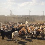
File photo of cattle on pasture northeast of Calgary. (James_Gabbert/iStock/Getty Images)

Prairie forecast: Mild temperatures to continue

Forecast issued Oct. 9, covering Oct. 9 to 16, 2024

As this forecast period starts, the Prairies are feeling the effects of an upper ridge as it slowly slides eastwards and breaks down thanks due to low-pressure tracking over the ridge. Here is where things get interesting. Overall, the models have consistently shown an area of low-pressure tracking over the ridge late this week and over the weekend. This low is forecasted to drop southeastwards and deepen dramatically.


Photo: File

Prairie forecast: Widespread frost then turning warmer

Forecast issued Oct. 2, covering Oct. 2 to 9, 2024

A large, deep area of low pressure is spinning over eastern Hudson Bay. Weak high pressure stretches across the northern part of the U.S. and into the southern Prairies. The strong counterclockwise rotation around the Hudson Bay low is pushing plenty of cool air southwards across the Prairies. Most regions have a good chance of frost early in this forecast period.

File photo of autumn colours around Lake Diefenbaker in Saskatchewan Landing Provincial Park. (Nancy Anderson/iStock/Getty Images)

Prairie forecast: Cooler, but still warmer than average

Forecast issued Sept. 25, covering Sept. 25 to Oct. 2, 2024

Despite a fairly unsettled pattern over the last forecast period, the weather models did a pretty good job of the forecast. For this forecast period, things should settle down a bit with a ridge of high pressure starting off our forecast. That doesn't mean that we won’t see any areas of low pressure, but unsurprisingly, the weather pattern is slowly shifting towards more of a fall pattern. That means quicker moving systems.

(Photo courtesy Canada Beef Inc.)

Prairie forecast: Weather pattern has undergone a shift

This forecast period starts with one of the northwestern U.S. lows slowly lifting northwards. The unsettled weather that started the week across parts of Saskatchewan and much of southern Manitoba looks to continue. It appears the low will only move out late Friday or early Saturday. Even parts of southern Alberta my see some rainfall from this low on Wednesday.


(Photo courtesy Canada Beef Inc.)

Prairie forecast: Cooler and wetter in the west, dry and warm in the east

Forecast issued Sept. 11, covering Sept. 11 to 18, 2024

Our weather pattern looks to be on the brink of a shift as a trough of low pressure begins to develop along the West  Coast. For those of you in Alberta, this will mean cooler and wetter conditions. In Manitoba, it looks like summer will continue for at least one more week. If you are in Saskatchewan, well, you will be stuck in the middle of these two features.