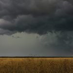
The lowdown on winter storms on the Prairies

It takes more than just a trough of low pressure to kick up a memorable winter storm

It takes more than just a trough of low pressure to develop an Alberta Clipper or Colorado Low, which are the biggest winter storms in Manitoba. It also takes humidity, temperature changes and a host of other variables coming into play.

Certain conditions can take a storm to the next level. photo: Xander/istock/getty images

Back to our look at severe summer weather

What makes a garden-variety thunderstorm an event to truly remember?

In the last issue we discussed humidity and dew point, and no, I did not realize at the time we were going to see some ridiculously high dew points during the short-lived heat wave that hit us on June 19. If you recall the article, life-threatening dew points have begun to occur in some subtropical
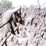

Snow covers soybeans in the field between Neepawa and Arden on October 3.

A look at our backwards October – November weather

Mother Nature seemed a bit mixed up at the start of the month, but eventually figured it out

Well, what can we say about October’s weather across the Canadian Prairies? I guess if I had to quickly describe it, I would say it was a backwards month. The month of October started off like it was the middle of November, with cold temperatures and snow. A large portion of the Prairies reported measurable

General weather pattern remains the same

Issued: Monday, July 27, 2015 – Covering: July 29 – August 5, 2015

Last week’s forecast played out pretty close to what was predicted, with the only exception that we didn’t really see much of a cool-down last Friday. It does look like we’ll see overall temperatures cool down a little during this forecast period as the general weather pattern undergoes a bit of a change. This is


Weather pleasant but a little fragile

Issued: Monday, Jan. 12, 2015 – Covering: Jan. 14 – Jan. 21, 2015

The start of this forecast period will see the last in a series of cold arctic highs push off to the east, which should result in milder conditions for the remainder of this forecast period and hopefully beyond. The best way to describe this forecast period is fragile. That is, while there are a couple

A cold and snowy month ahead?

Another month has come and gone and 2013 is quickly coming to an end. While it is a little too soon to make a summary of this past year’s weather, it’s time to see how November’s numbers added up. November started off fairly nice, with daytime highs pushing the 10 C mark in the first


No significant storms in sight

Weather forecast for week of Nov. 11, 2013

Last week’s forecast pretty much fell apart after the weekend, as a very strong area of arctic high pressure dropped southeastward, bringing the coldest air of the season to all areas. Luckily this area of high pressure moved through quickly, resulting in only a day or two of cold air. This forecast period looks to

Is the jet stream getting stuck more often?

It’s best to hope these ‘blocking patterns’ don’t become the norm This is one of those weeks when I’m just not sure what to write about, so I thought I’d discuss some ongoing weather research that just might help us understand how we could go from a record-warm March to a record-cold April in just


2013: The year without a spring?

Back in 2004 we had the year without a “proper” summer. Last winter it was probably the closest we could come to a year without a winter. Maybe this year it’s going to be the year without a spring. The longer we remain in what can only be described as a “deep freeze,” the better

Out like a lamb and in like a lamb

When we have a quiet weather pattern with no strong systems affecting our region, it can sometimes be a little tough in the late winter and early spring to figure out just what will happen in regards to the weather. While last week’s forecast wasn’t too bad, it did miss out on a lot of