Rural Manitobans remained on high alert this week as rising flood waters continued to spread across the province, forcing people from their homes, washing out roads and inundating farmland.
With crests on the province’s two major rivers, the Red and Assiniboine, expected by early next week, flooding also remained general along most of the smaller tributaries.
From western Manitoba to the central, Interlake and southeastern regions, roads are cut, communities are under flood alert and local authorities have declared states of emergency as some residents brace for even more water in the days ahead.
Read Also
Making way for Port of Churchill expansion
Rail car limits, climate research and marine planning will determine if the Port of Churchill actually can grow beyond its four-month shipping season into year-round trade.
The 2011 flood is of “unprecedented geographic scope,” said Emergency Measures Minister Steve Ashton in one of the daily media briefings.
“Due to the warming trend, snowpackaffected streams such as Swan, Turtle, Shell, Pine, Garland, Ochre, Vermillion and Valley rivers have just started runoff in the upper watershed regions,” the province said in a bulletin early this week. Secondary crests are expected as a later-than-usual snowmelt gets underway.
Provincial officials have warned the province could experience flooding until well into May, unwelcome news for the nearly 1,000 people forced to evacuate.
As of last week, flooding had prompted 32 rural municipalities to declare local states of emergency, double the number during the entire 2009 flood. More were expected.
Also, 77 provincial roads were affected by flood water with 55 of them closed or accessible only to local traffic. About 530 municipal roads were closed.
Kelly Belhumeur of St. Lazare said this year’s flooding along the Qu’Appelle River is the worst his family has seen. “My dad has lived there all his life and he has never had to be evacuated before,” said Kelly.
The family left their home protected by a plastic-lined dike built by family and friends and moved in with relatives until the waters recede.
“All our land is under water,” Belhumeur said. “It’s a waste. No seeding this year. Last year there was nothing either.”
Last fall, heavy rains kept the land soaked and the river full. Then, record snowfall that melted this spring pushed the Qu’Appelle over its banks and flooded them out.
Martin Dupont, mayor of St. Lazare, said that it appears the Qu’Appelle River has crested, but that the level of the Assiniboine will depend on how excess flows from the Shellmouth Dam are managed.
Gates at the dam have been opened in an attempt to keep water levels above the dam from going over the top. If that happens, all control will be lost, he said.
“It’s a game they’re playing. They are trying to level it out,” said Dupont.
Farther south in Melita, it was reported that the Souris River had crested, but not before it sparked a rush of dike building earlier last week. A secondary line of defence made up of Hesco barriers was built to protect businesses in the town after rising waters briefly flowed over Hwy. 3 April 20.
Cliff Penno, a rancher and order buyer who lives part time at a farmyard on #345 just west of Lauder, was flooded out by a combination of the Souris River and the Maple Lakes drain.
He has had to move his cow herd up to higher ground right in the middle of calving season, which means he can’t use his existing handling facilities.
“We’re going to have to do it cowboy style and try to calve them on the grass, and hope that we don’t lose too many,” said Penno.
The Red River continues to rise with its crest expected in Winnipeg around May 2. The Assiniboine River was expected to crest in the city between April 27 and May 1.
The province predicts Red River flood levels will rival those experienced in 2009, which recorded the second-worst flooding since 1900.
An unusual combination of coinciding factors is responsible for the unprecedented flooding this spring, said Steve Topping, Manitoba Water Stewardship’s executive director of infrastructure and operations.
Topping said southern Manitoba saw record precipitation during 2010, resulting in record-high soil moisture conditions at freeze-up. The same was true in North Dakota and Minnesota, which also recorded well-above-normal snowfall during the winter. So, too, did the upper Assiniboine basin in eastern Saskatchewan and the Winnipeg River watershed in northern Ontario.
In the Interlake region, high lake levels resulting from three straight years of abnormally wet weather are producing extensive overland flooding with water moving from one lake to another. River flows are high, too, with the Icelandic and Fisher rivers near record levels, Topping said.
“You have all these factors coming together at the same time: flood levels, water levels, high flow rates and unusual water conditions,” he said.
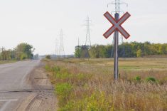
Flooding along the Red River last week forced Canadian Pacific to reroute trains on one Manitoba branch line and to close another, while Canadian National Railway closed a secondary line.
The province was building dikes across two of CP’s lines to protect the towns of Emerson and Morris.CN closed its secondary line between Winnipeg and North Dakota to allow for building the dike at Morris. (with files from Reuters)
———
“We’regoingtohavetodoit cowboystyleandtrytocalve themonthegrass,andhope thatwedon’tlosetoomany.”
– CLIFF PENNO