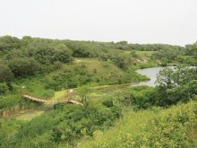
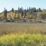
5._Cypress_River_Mellinnium_Park_DONNA_GAMACHE_cmyk.jpg
The view from the marsh at Cypress River Millennium Park.
Photo: Donna Gamache
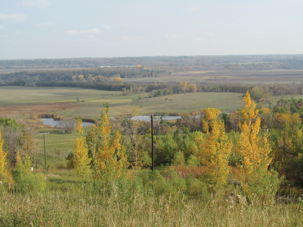
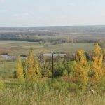
6._Assiboine_Valley_coming_from_the_south_on__34_highway_DONNA_GAMACHE_cmyk.jpg
A lookout along Highway 34 shows off the Assiniboine River Valley.
Photo: Donna Gamache
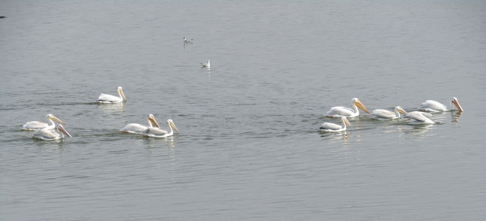
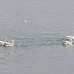
4._along_Pelican_Lake_DONNA_GAMACHE_cmyk.jpg
The water body’s namesake birds float on Pelican Lake.
Photo: Donna Gamache
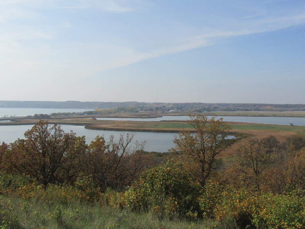
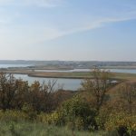
3._Pelican_Lake_from_viewpoint_DONNA_GAMACHE_cmyk.jpg
The shores of Pelican Lake spread out under the Ninette viewpoint.
Photo: Donna Gamache
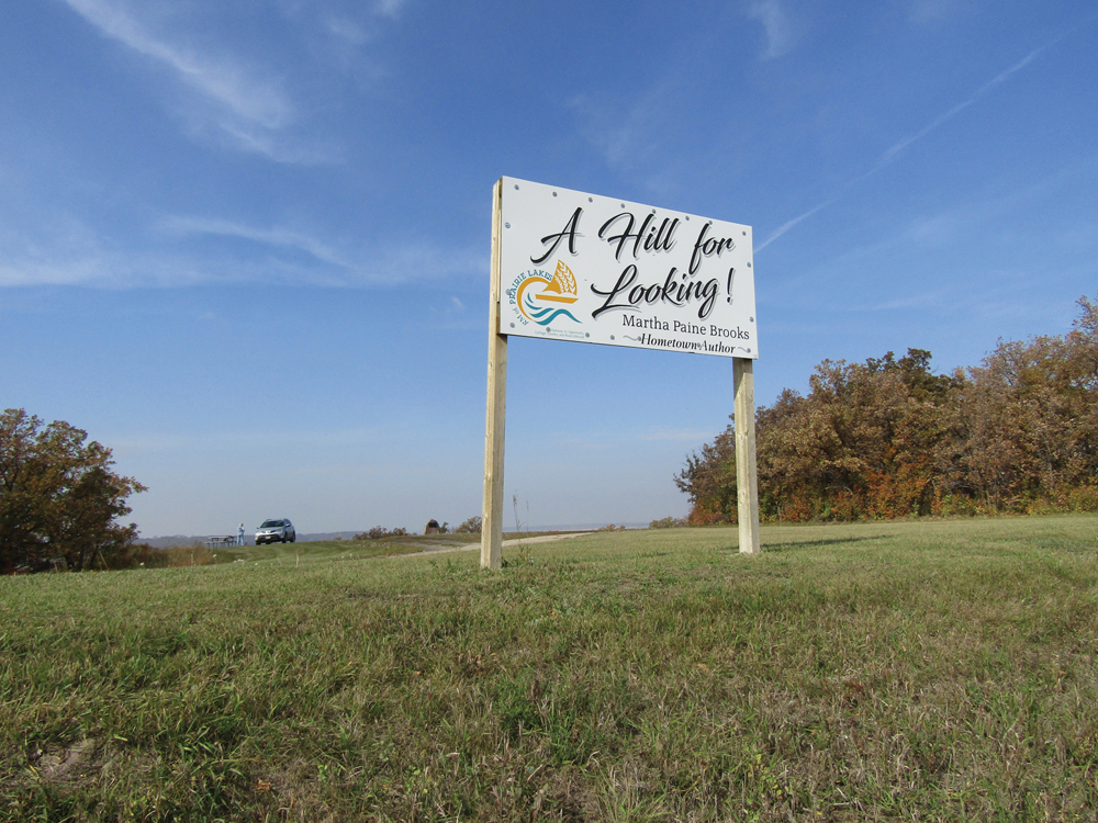
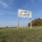
2._Pelican_Lake_viewpoint_sign_DONNA_GAMACHE_cmyk.jpg
A sign referencing local author Martha Paine Brooks welcomes visitors to the viewpoint at Ninette, Man.
Photo: Donna Gamache

1._view_along_Marshs_Lake_Walk,_Spruce_Woods_DONNA_GAMACHE_cmyk.jpg
Foliage shows its best seasonal colours on the Marshs Lake walk in Spruce Woods Provincial Park.
Photo: Donna Gamache
The treed landscapes of Manitoba are arguably at their most spectacular this time of year, and it’s prime time for a driving tour while leaves are at their best.
With autumn winds ready to wreak havoc with the foliage, this can sometimes be a short window of opportunity.
Tips for the road
Read Also
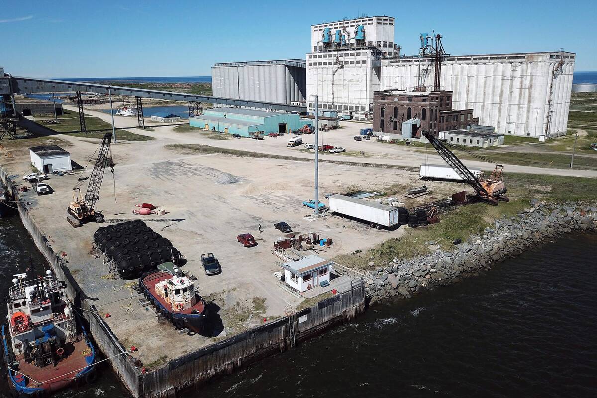
Making way for Port of Churchill expansion
Rail car limits, climate research and marine planning will determine if the Port of Churchill actually can grow beyond its four-month shipping season into year-round trade.
Plan your drive with a road map or use the Manitoba Backroad Mapbook, an excellent resource that notes all the mile roads. This is available at the Brandon Riverbank Discovery Centre and many co-op gas stations in the province.
One day trip I recommend, especially in the fall, is a somewhat circular loop beginning in Carberry and going south on Highway 5. This takes you through Spruce Woods Provincial Park and the Assiniboine River Valley and can be very scenic if you do it when leaves are changing. Plan a stop at Marshs Lake for some photography or walk the self-guiding trail, which is just under two kilometres.
From there, continue south on the highway, past Glenboro, to the junction with Highway 23. Then head west to Ninette. This route will bring you to the east side of Pelican Lake and a beautiful overlook of the lake and valley. You’ll see a sign labelled “A Hill for Looking,” which pays homage to a book title from author Martha Paine Brooks, whose father, Dr. Alfred Paine, ran the lakeside tuberculosis sanatorium just below the hill. She wrote about her childhood in the area.
More than a dozen buildings made up the facility, which took in patients from 1909 to 1972 and was the largest sanatorium in the province.
After it closed, it was converted to a training centre for intellectual disabilities. It operated in that role from 1973 to 2000, before being used for several years as a Christian conference centre.
Today, the sanatorium sits vacant and many of the buildings have been torn down. A few remain and can be viewed from the outside. The facility is classed as a historic site of Manitoba. For more information, see the Manitoba Historical Society’s website.
While enjoying the overlook, be sure to read the on-site monument to Dr. Paine. There is a picnic table available too. Then check out the sanatorium site and explore the roads around both sides of the lake and through the town of Ninette.
Stop for a walk around the Terry Fox Memorial Park – Fox’s grandparents were from this town – and the Pelican Yacht Club. Sailboats may still be operating, and pelicans, cormorants and gulls flock along the shore.
From Ninette, you can backtrack east on Highway 23 and continue past Baldur about 11 km, where you will turn north on Provincial Road 342 (also labelled 73 W). Drive about 22 km north to Cypress River.
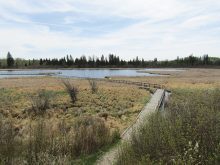
On the north side of the village, situated on the north side of Highway 2, is the Cypress River Millennium Park, a pleasant spot for a picnic or short stroll. Informative signs give details about the Assiniboine Delta Aquifer and the important role wetlands play in the landscape.
Check out the boardwalks and ponds on the Wetland Discovery Trail and watch for wood duck nest boxes along the way. Canada Geese and a variety of ducks could be observed on the park’s largest pond during my visit last fall.
From Cypress River, drive east on Highway 2 until it meets Highway 34. Turn north to go through the Assiniboine River Valley once more, where the view almost demands a photo stop. A picnic spot on the north side of the river is another possible stopping point.
From here, you can continue north on Highway 34 until it meets the TransCanada Highway, which will take you back through the scenic Carberry Hills to your starting point.
Should you wish for one more stop, try the Seton Provincial Park west of the village of Sidney. This is a Manitoba historical site named for the famous naturalist, artist and writer Ernest Thompson Seton. The nearby hills were the setting for some of his books, such as “Wild Animals I Have Known.”
For more information on Seton, visit the Manitoba Historical Society website.