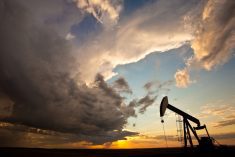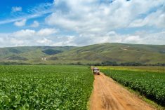

Glacier FarmMedia—To Scott Kehler the weather across the Prairies will essentially be two stories during the first half of June.
“We are starting to see hints of warmer weather arriving in Alberta,” the chief scientist for Weatherlogics stated, noting that Manitoba and Saskatchewan are to get temperatures that are normal to below normal.
“In the early part of the month we are expecting a ridge in the jet stream to build over British Columbia, so that tends to bring warmer weather. But it doesn’t look like it’s going to last for a really long time though,” Kehler said.
Read Also
Prairie forecast: All aboard the temperature rollercoaster
A series of lows, and the cold and warm air masses that come with them, will make for a temperature rollercoaster on the Prairies.
While that phenomenon pertaining to the jet stream isn’t expected to last, he said it will be very active for its duration.
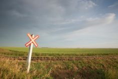
Manitoba will be the wetter province in early June and Alberta will be drier. Saskatchewan will be a mixed bag being wetter in some parts and other parts being drier,” he explained.
Going in the second half of June, Kehler said the pattern may change but it was still too early to say.
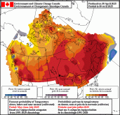
On June 3, Environment and Climate Change Canada issued its outlook for the summer, which called for a 60 per cent chance for above-normal temperatures during June, July and August, with Manitoba at 80 per cent.
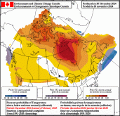
As for precipitation, ECCC projected parts of southern Alberta, the province’s northeast, along with central Saskatchewan and northern Manitoba to have a 40 per cent chance of a drier summer. The southernmost areas of Alberta were pegged at more than 50 per cent drier than normal.