Manitoba Agriculture, Food and Rural Development (MAFRD) – MAFRD has released the map for where the distribution of clubroot has been found in Manitoba (as of June 4, 2014).
The map shows positive clubroot (CR) findings by Rural Municipalities (RM) discovered through soil and/or plant tissue analysis for presence of CR DNA or symptomatic plants from sampling done between 2009-2013. Testing to date has been limited; positive findings have been sporadic and at low concentrations throughout the province. As more fields are sampled, the map will be updated.
Read Also
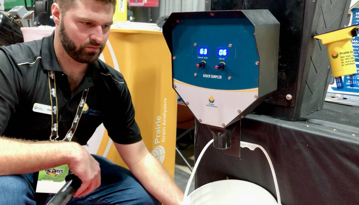
Grain auger sampler takes top prize at Ag Days
Manitoba company Prairie Grain Analyzers has invented a grain sampler device that automatically takes samples of grain from an auger while it’s running.
As less than 2 per cent of the farms in Manitoba have been sampled, it is recommended to assume that CR DNA is within 50 km of your farm, but may not yet have been identified. Cleaning of both agricultural and non-agricultural equipment is recommended, removing visible soil and plant debris off equipment using shovel, scraper, and/or compressed air. Once an RM is determined to be positive, then cleaning of equipment as previously recommended is necessary and should be followed by a water wash and a disinfectant (eg. 2 per cent bleach).
Note: In Manitoba, CR positive fields are defined as where DNA of the CR pathogen, Plasmodiophora brassicae, has been confirmed in soil or fields where canola plants with clubroot symptoms have been found. To date, CR disease has been confirmed in 13 Manitoba fields.